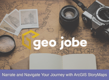
Take advantage of one of Esri’s best marketing tools, ArcGIS StoryMaps. Whether you are advertising your products, selling property, advocating for a cause, or even wanting to provide your company’s background, StoryMaps has it all. Working in an Enterprise environment? No worries, ArcGIS StoryMaps is available to you, too! Telling Your Story For this article, […]
Search Results for: story map
2023: Mapping the Milestones
As GEO Jobe enters its 25th year of operation in 2024, one word best represents this past year in the company’s history: growth. The company has seen continued growth and expansion over the past 25 years, but in 2023, GEO Jobe experienced some of its greatest milestones yet. Per tradition, we are taking a moment […]
Creating Custom ArcGIS Map Widgets as React Components: Part 2
In a previous GEO Jobe blog article, we began the process of setting up a React application to develop custom ArcGIS Map widgets as React components. This article takes the next step in creating custom widgets by introducing some actual functionality to our example CustomWidget. Note: This tutorial assumes a basic understanding of building web […]
Mapping Mississippi: 2024 Mississippi Mapping Competition
In This Article… What is the Mississippi Mapping Competition? The Mississippi Mapping Competition is the state’s effort into Esri’s ArcGIS Online competition for U.S. high school and middle school students. Through this competition, students from Grades 4-12 can enter an ArcGIS StoryMap that tells a story about the State of Mississippi. From the entries, a […]

Learn GIS with the Best at Esri
Further your GIS knowledge with Esri MOOCs and more! The GIS field is a vast field with multiple specializations and consistent new developments. While a GIS analyst may be specialized in one area, they may not be aware of features in another area, or even how new developments may apply to their field. One way for […]
Backup My Org 1.4 is Now Available
We are excited to announce the latest release of Backup My Org, version 1.4, is now available! Focused on stability, this massive new release is packed with 5 new features, 62 improvements, and 94 bug fixes designed to give you the best backup and restoration experience possible. Let’s dive into what’s new! New Features Option […]
Leave the Driving to GIS
Image designed by Freepik Having grown up on a healthy diet of cartoons and sci-fi shows, I have always been anxiously waiting for the things I saw on the screen or read in a book to make their way into my everyday life. The Jetsons promised flying cars with autopilot features. Many a summer Hollywood blockbuster […]
Building a Model for a More Powerful Workflow
Leveraging Inline Variable Substitution Introduction ModelBuilder™ is a tool within ArcGIS® Pro that allows the user to combine different geoprocessing tools and steps to help automate geoprocessing workflows. ModelBuilder enables users to connect various geoprocessing tools built into ArcGIS Pro and custom geoprocessing tools in a set sequence to reach desired data output(s). The model […]

Dive Into Dev Tools, Part 2: Elements
If you missed Part 1, you can read that here. Any modern browser you use to access the internet has something called “Developer Tools,” “The Developer Console,” or something similar. Collectively, these are commonly referred to as Dev Tools. Almost every web developer will leverage them, but how? In this article, we dive deeper into […]

How Can GIS Services Help Companies Stay Competitive?
What Are GIS Services? GIS services can be a wide range of services such as UAV digital mapping, solution engineering, or spatial data collection/development. Services such as these can allow businesses to produce successful geospatial solutions. UAV digital mapping can construct high-resolution orthophotos (aerial imagery), 3D models, 3D point clouds, etc., to represent landforms. Solution […]