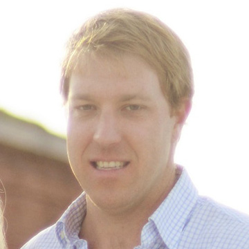
Here is a short Q & A with UAV Business Development lead, Reed Davis. Reed joined the GEO Jobe team in January of 2021 and is based out of our office in Gulfport, MS.
Q: What is your job at GEO Jobe, and what does it entail?
A: I’m head of GEO Jobe’s UAV department. We provide high accuracy, full service, UAV data capture. Our team creates digital mapping products from this UAV collected data. Products include 3D modeling, orthomosaic imagery, topographic contours and raster surfaces. We serve engineers, developers, utilities, government agencies and many other industries.
Q: What has your career path at GEO Jobe looked like, and what attracted you to join the team?
A: Having worked in the geospatial industry for over a decade I was familiar with GEO Jobe, which is known as a standard of excellence in our community. I was thrilled when the opportunity to join the team was presented. Their innovative, adaptive attitude with an emphasis on learning and growth is what attracted me.
Q: What jobs and experiences have led you to your present position?
A: Upon completing my bachelor of geographic information science at USM, I began working as a Navy contractor piloting remotely operated submersibles. Next, I worked for the city of Biloxi as a GIS Analyst, during this time I taught myself to use UAV equipment to map city engineering projects. This led me to earn my remote pilot certification and the UAV department at GEO Jobe.

Q: What particular skills or talents are most essential to be effective in your job?
A: Familiarity with photogrammetry techniques is essential to producing orthomosaic imagery and 3D models, not only during imagery production but more importantly during image acquisition. Digital mapping and GIS are critical skills to understanding the implementations and environments where our data will be used. Knowledge of UAV operations and flight characteristics are the basis for safe and efficient data capture. Reading aeronautical charts is fundamental to knowing when and how UAV flights can safely integrate into the national airspace.
Q: Any advice for recent graduates entering the job market and aspiring to a similar role?
A: Learn part 107 rules, understand airspace, and then go fly! There are free, open-source photogrammetry applications available; learn the basics and start mapping. Some professional software applications like Pix4D offer trials and demos to practice your skills. There is no better way to learn than by doing. You don’t need a survey-grade UAV to get started, find an inexpensive or second-hand drone and learn to use it.
Q: What technologies and strategies do you use in your day-to-day work that are key to success?
A: Photogrammetry is the secret to UAV mapping. Pix4D is one of the most powerful tools I have in my arsenal. There are more simplified applications, but Pix4D is the industry standard for a reason, it offers advanced controls and enables you to edit outputs at each stage of processing. To run Pix4D, ArcGIS Pro and other graphically intense software applications, you’ll need a high-end, dedicated GPU, plenty of high-speed memory, and the fastest processor you can get.
Q: What would you like to learn more about or incorporate into your daily work?
A: Innovative data capture techniques, creating digital twins to the most accurate degree possible, and utilizing new sensors to visualize reality from unique perspectives are a few things I’m currently working on. I’m part of a team using machine learning object detection techniques that greatly expedite feature extraction and classification. GeoAI is the future, our team is building applications to leverage the power of AI and machine learning to complete tasks faster and more efficiently than ever before.

Q: On a more personal side, do you have a favorite newspaper, magazine, blog, or sources of inspiration?
A: I’m the guy that reads the owner’s manual; technical documentation and repair manuals are some of my favorites. Knowing how and why things work is the key to effective troubleshooting. My favorite authors are Michael Crichton and Ray Bradbury.
Q: What kind of technology do you prefer and why? (Mac or PC, iOS or Android, and other cool tech)
A: Linux is my preference. Unfortunately, the software applications I use for my job do not easily or efficiently translate onto the Linux environment so I am stuck with Windows. A huge advantage of Linux operating systems is that minimal system resources are required to run it efficiently, there’s not a lot of fancy visuals, Linux just works. I’ve had Linux machines that were left running, without a restart, for over a year with no issues or slowing. Open-source operating systems like Linux and Android allow for maximum innovation as the code is freely available for anyone to modify.
Q: What do you enjoy doing outside of the office?
A: I’ve been flying drones for nearly a decade. Traveling and exploring is my favorite way to spend vacation time; the best way to learn about a new place is to visit. Capturing drone videos and photographs in new locations is one of my favorite activities. My family and I love to spend time together outdoors. Swimming, hiking, kayaking and fishing are some of our favorite activities.
You can connect directly with Reed and the GEO Jobe team, via connect@geo-jobe.com.
Looking for more articles? Check out these!