

We’re pleased to announce something new this week to support the users of our popular applications and for ArcGIS and ArcGIS Online enterprise users – the GEO Jobe Knowledge Base (Kbase). Developed by our support team, the knowledge base promises to be your go-to help and information resource to answer all your questions about our products for ArcGIS and ArcGIS Online enterprise users, Admin Tools, Mapfolio, MapLapse, and the geo powered cloud.

The GEO Jobe Knowledge Base is a public, community resource where users and those interested in GEO Jobe’s enterprise solutions, particularly Admin Tools for ArcGIS Online and the geo powered cloud solution, can access help resources, answers to frequently asked questions, articles, support documents, and more via a friendly, easy to use, helpful web site.
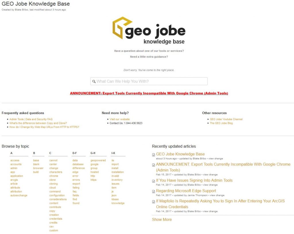
Designed using a friendly, simple to use layout, organized by topic, the knowledge base provides a wealth of information to users. Key sections of the resource include a list of frequently asked questions (FAQ), a handy list of recently updated articles, alphabetical listing of topics, and links to other support resources. The community is invited to access the Knowledge base at https://geo-jobe.com/kbase
Participants are encouraged to ask questions and provide suggestions for future product direction.
See also the official PR announcement
