Unmanned Aerial Vehicle (UAV) Examples
A selection of mapping, imagery, digital twin, and data creation projects.
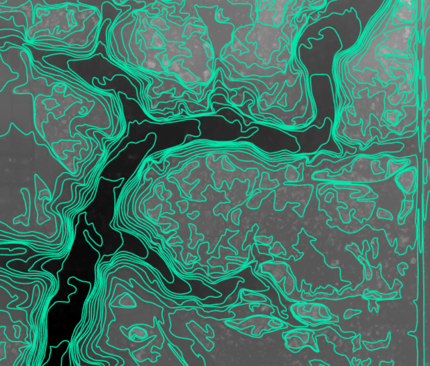
Topographic Contours
Elevation Mapping
Informed decision-making for site analysis, infrastructure design, and land development.
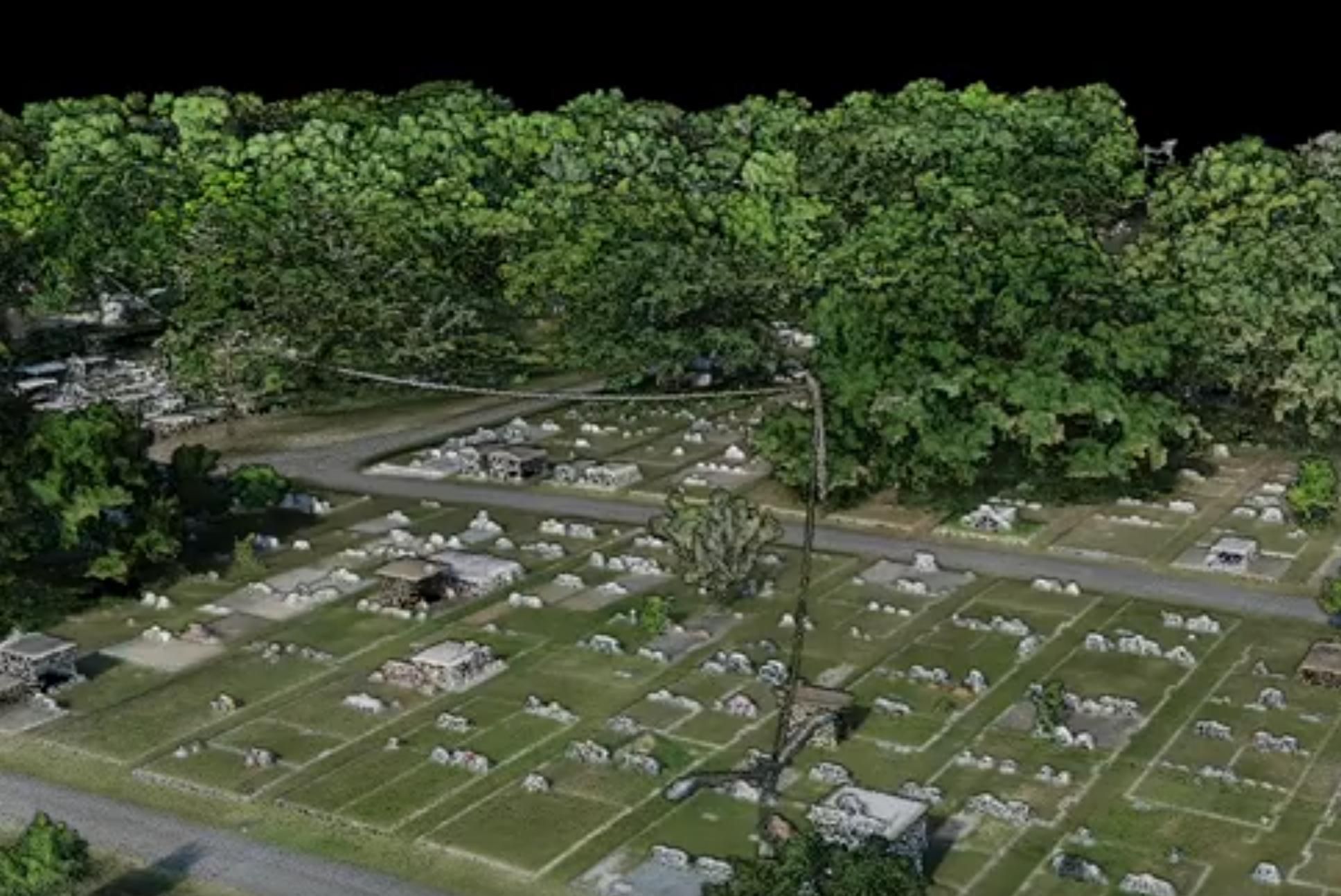
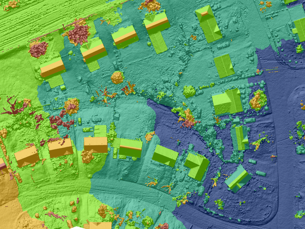
LiDAR Mapping
Laser Elevation Data
High resolution 3D models and elevation surfaces. LiDAR penetrates dense vegetation providing accurate elevations.
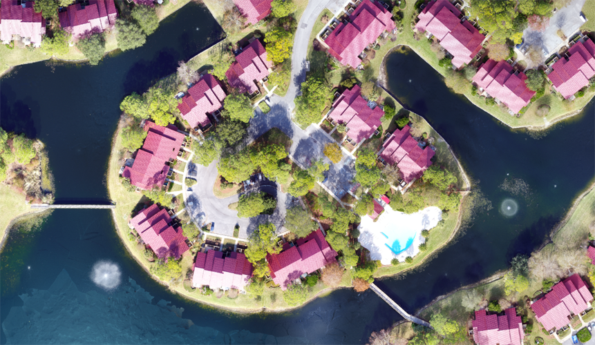
High Resolution Imagery
Aerial Mapping
Precise, up-to-date imagery, enhances design accuracy, and provides valuable insights.
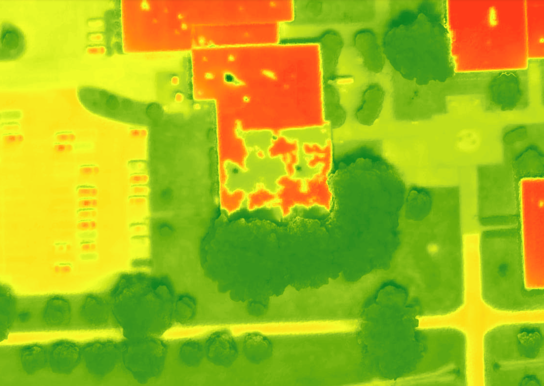
Thermal Inspection
Thermal Mapping Products
Prevent critical infrastructure failure with early detection; post-disaster assessment.
Feature Extraction
GIS Data Creation
Quickly generate accurate data for spatial analysis, project planning, and informed land use decisions.
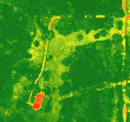
NDVI Multispectral Industry
Vegetation Index Mapping
Quickly identify vegetation health, eliminate overspray, mapping for machine control.
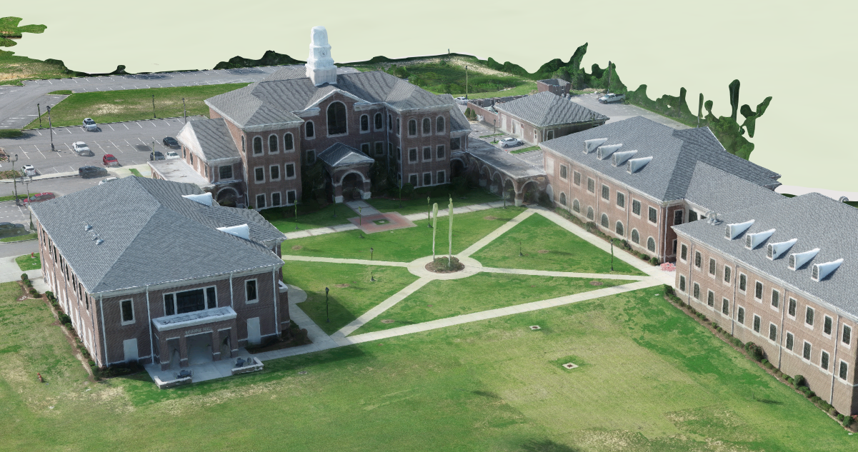
3D Modeling
Digital Twin
Realistic 3D models, accurate volume calculation, measurements and documentation. Share to ArcGIS Online.
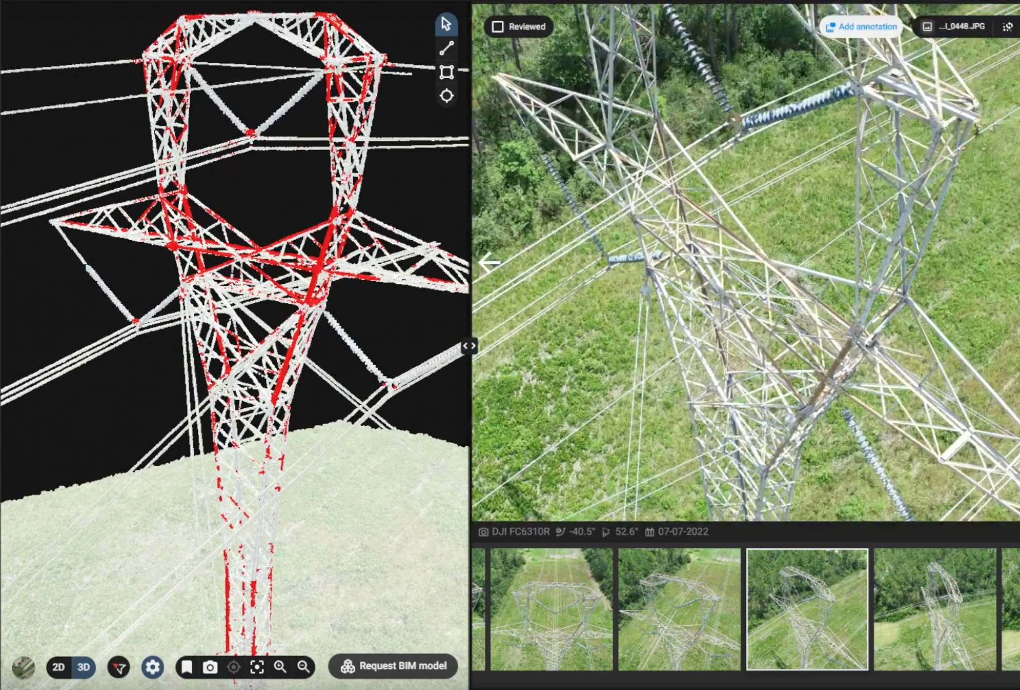
Asset Inspection
Intelligent digital twin
Corrosion detection, identify structural deficiencies, change detection, vegetation encroachment.
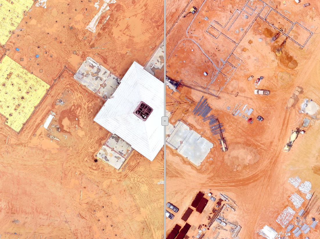
Construction Modeling
Temporal Scans
Record utility location during installation. Easily locate buried assets. True to reality As-Built documentation.