Unmanned Aerial Vehicle (UAV) Digital Mapping Services
GEO Jobe has offered UAV services for more than a decade, collecting aerial imagery and creating digital mapping products. These solutions have become essential to workflows in a variety of industries, including utilities, local government, planning, surveying, and engineering. GEO Jobe’s UAV Team is able to quickly capture data and provide services at a competitive price, enabling clients to maintain current and accurate GIS data.
Surveying, Architecture, Engineering, and Construction
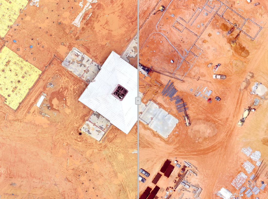
We deliver survey-grade LiDAR and high-resolution imagery, cutting field time by up to 70% compared to traditional crews. Our topographic contours, TINs, and DEM datasets give engineers accurate design surfaces faster, reducing costly rework and accelerating project timelines.
Key Services
- LiDAR-based DEM/TIN for grading/design
- Construction progress documentation (orthos + 3D models)
- Cut/fill and volume analysis (stockpiles, earthwork)
Asset Management and Inspection (Energy, Infrastructure)
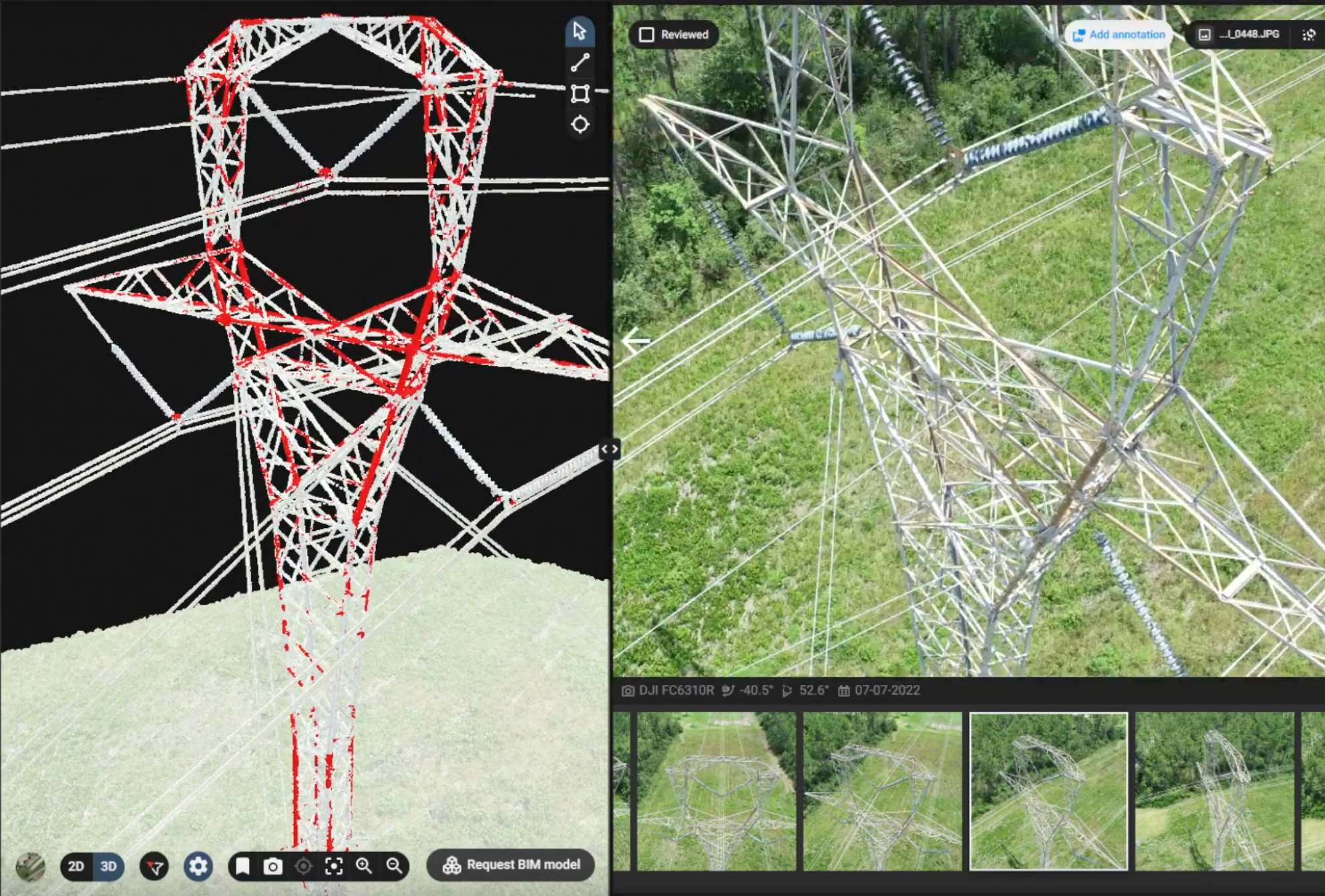
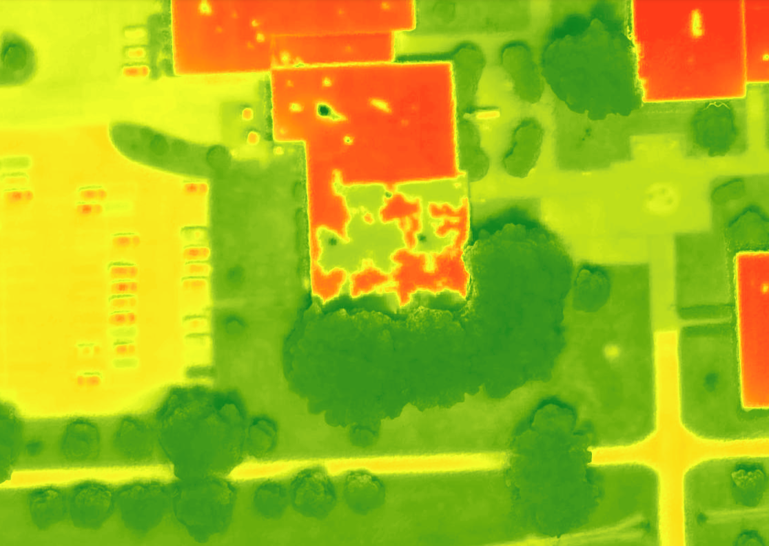
We help utilities and energy companies reduce inspection costs and minimize downtime by using high density LiDAR, RGB, and thermal imaging to capture detailed data without the need for bucket trucks or helicopters. UAV inspections improve safety, shorten inspection cycles, and provide quantifiable data to support preventative maintenance.
Key Services
- Transmission corridor mapping
- Pipeline ROW monitoring
- Solar array thermal inspection
- Wind turbine blade inspection
Environmental Consulting Services
Our UAV-based LiDAR, multispectral, and thermal solutions deliver fast, safe, and more cost-effective environmental monitoring than traditional field surveys. From wetland delineation to orphan well monitoring, we provide high-resolution data, improving decision-making while reducing field hours and regulatory risk.
Key Services
- Wetland delineation
- Coastal erosion & floodplain mapping
- Orphan well monitoring
- Environmental Compliance
Additional Resources
YouTube
Our YouTube Page is filled with helpful videos, showcasing past successes as well as serving as inspiration for projects yet to come!
UAV Example Gallery
This gallery contains many example web maps and applications which make use of GEO Jobe UAV Services.
Working with GEO Jobe Data Science
A joint project working on a Vegetation Health Analysis and Canopy Quantification using machine learning and UAV-collected data.
Vertical Asset
Vertical assets such as communications, tall buildings, or water towers are difficult and dangerous to inspect. For this reason, UAV technology is quickly becoming the preferred method of vertical asset inspection.