


Tree Canopy Classification – Vanderbilt University Campus Nashville
Quantifying tree canopy cover across expansive areas has historically been a time-consuming endeavor, often reliant on labor-intensive field surveys or manually analyzing traditional aerial imagery. Such methods are not only cumbersome but also prone to error. Through the innovative application of Unmanned Aerial Vehicle (UAV) technology, significant time and cost savings are realized while achieving superior accuracy in tree canopy classification.
Project Overview
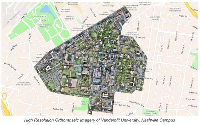
GEO Jobe produced high resolution orthomosaic imagery of Vanderbilt University’s campus using a fixed wing UAV, maximizing efficiency and reducing the time needed for on-site surveys. Supervised machine learning was utilized to detect and classify canopy cover over the large campus area; the result is a classified raster image. Statistical analysis was then performed on the classified data, delivering actionable insights for land use planning.
The Challenge
The primary challenge was the transformation of traditional canopy quantification techniques into a streamlined, UAV-powered workflow. This required overcoming technological and logistical hurdles, including optimizing flight paths, enhancing image quality, and streamlining data processing pipelines. Additionally, the task of accurately classifying diverse tree canopies, often overlapping and varying in density, posed a significant obstacle.
To address these challenges, the project team engaged in meticulous planning and collaboration. Flight routes were charted to guarantee complete coverage, while advanced imaging technology was employed to capture high-quality data. Through iterative training of machine learning algorithms, our data science team achieved impressive accuracy in distinguishing and classifying tree canopy.
Overcoming these challenges underscores the transformative potential of UAV in reshaping conventional practices of environmental analysis and decision-making.
Methodology
1. UAV Imagery Acquisition – eBee X
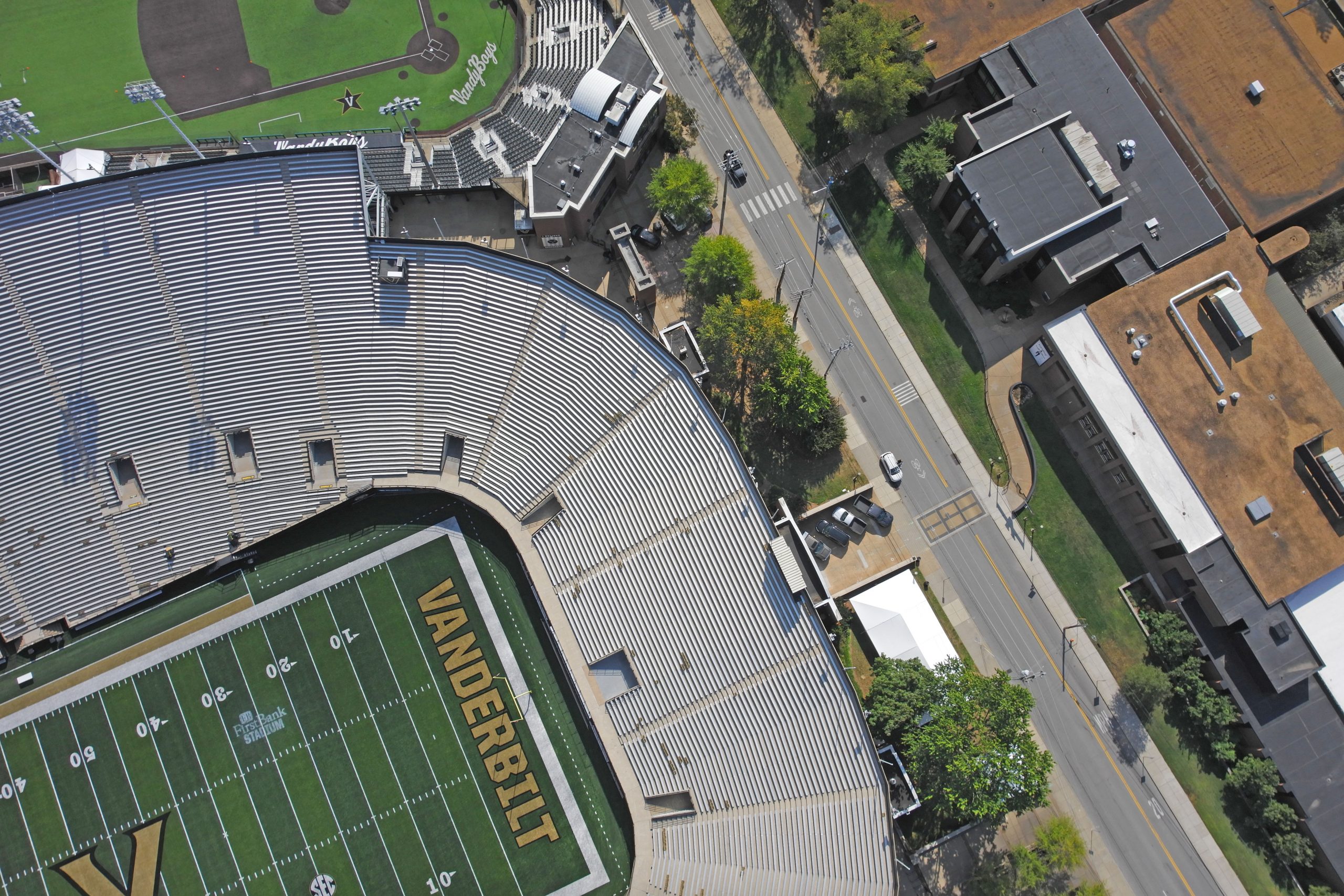
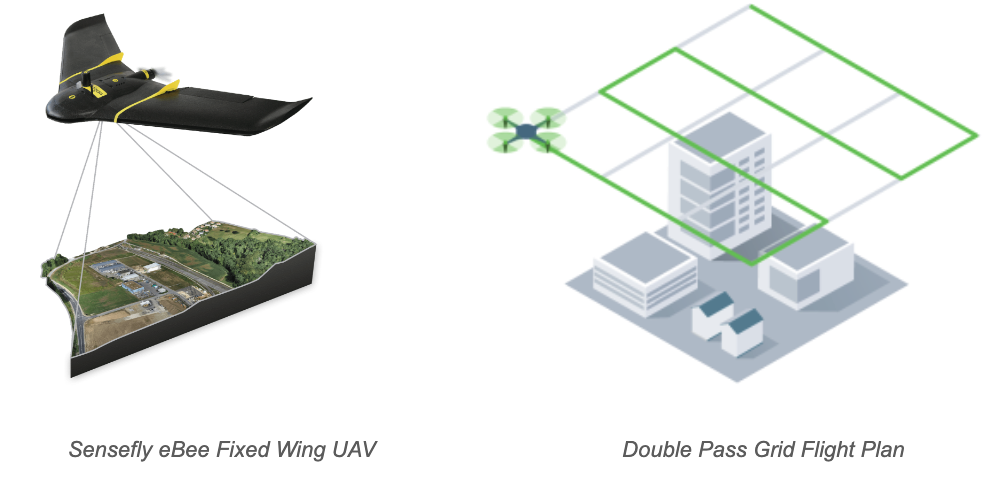
GEO Jobe’s UAV team captured imagery with an eBee X mapping drone. This fixed wing drone allows for maximum efficiency when mapping large areas. The drone was flown over Vanderbilt campus, capturing high-resolution imagery of the land surface.
Utilizing a tilting gimbal 3D payload, both oblique and nadir images are captured simultaneously. Our fixed wing UAV enables rapid and comprehensive coverage of the project area, drastically cutting down data acquisition time. This technique allows us to produce orthomosaic imagery at one-inch pixel resolution or better.
2. Orthomosaic Generation – Pix4DMapper
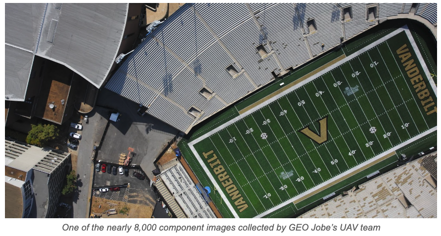
Once the UAV imagery is collected, it undergoes further processing to create an orthomosaic. This is achieved through the use of Pix4D photogrammetry software, which stitches together nearly 8,000 individual images to produce a georeferenced map that is corrected for both distance and perspective. The resulting 400-acre orthomosaic serves as the foundation for supervised classification.
This integration of UAV technology with cutting-edge software tools, such as Pix4DMapper and ArcGIS Pro, not only expedites data analysis but also dramatically minimizes the manual effort required for image stitching. Fully processed orthomosaic imagery is provided to our Data Science team, who developed a land cover classification model to detect and identify tree canopy.
3. Machine Learning Classification – ArcGIS Pro
Orthomosaic imagery is utilized as the input for supervised machine learning classification. Using ArcGIS Pro to label, train, and apply the classification algorithm, our data science team created a highly accurate model to identify canopy cover.
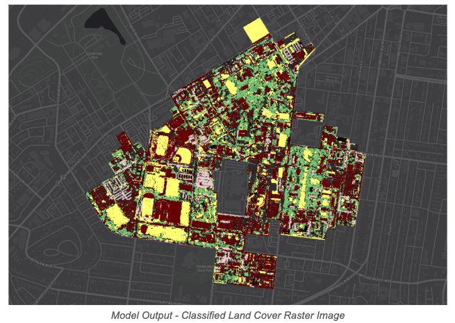
The machine learning model is trained using labeled samples of both canopy and non-canopy areas, allowing it to classify different land cover types within the imagery. Once imagery is classified, automatic and manual quality checks are performed to validate the data. The result is a classified raster image, which is used to analyze canopy distribution.
Automating classification of canopy cover significantly reduces the need for manual labor, ensuring consistent and accurate results, as the data science team can focus on refining the model and validating the results, rather than expending resources on manual tasks.
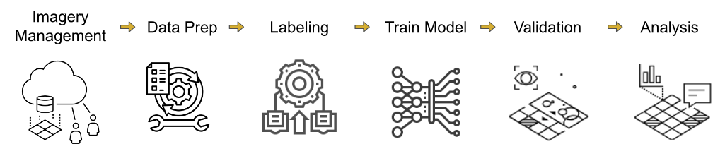
4. Classified Raster Analysis to generate percent coverage Statistics Using ArcGIS Pro
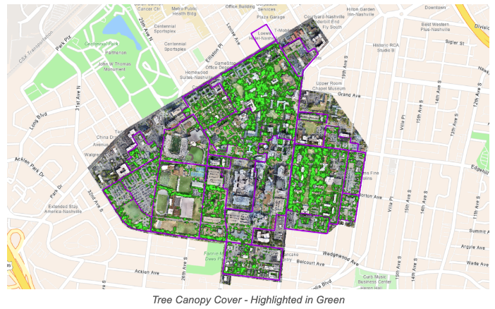
After machine learning algorithms are applied and a classified raster is produced, the data is analyzed to generate statistics related to canopy coverage. ArcGIS Pro is again utilized for this purpose. Using raster functions and geoprocessing tools, we calculate the percentage of the area covered by tree canopy and determine the ranking of different areas based on their canopy coverage. These statistics provide valuable insights into the distribution and extent of tree canopies within the study area.
The Results
Each region of the project area, as defined by the Vanderbilt GIS department, is ranked according to canopy cover. This data will be used to record and analyze the distribution of canopy coverage. Performing similar analysis on past and future datasets will allow Vanderbilt to reveal trends, optimize landscape planning efforts, and identify areas of high priority.
Conclusion
Traditional data collection methods necessitate prolonged fieldwork and intricate post-processing. In contrast, UAV data capture enables rapid and comprehensive coverage of the project area, drastically reducing data acquisition time.
By utilizing high-resolution orthomosaic imagery captured by our fixed-wing drone, implementing supervised machine learning, and conducting statistical analysis, GEO Jobe enables Vanderbilt to achieve accurate, up-to-date, and comprehensive insights into tree canopy coverage.
The result is not only a more efficient approach to data collection but also a substantial reduction in resource expenditures for land use planning efforts.

Interested in learning more about GEO Jobe’s UAV Services? Visit our UAV Services page or send us an email at connect@geo-jobe.com.
Check out these other Case Study articles:
