
State and Local Government
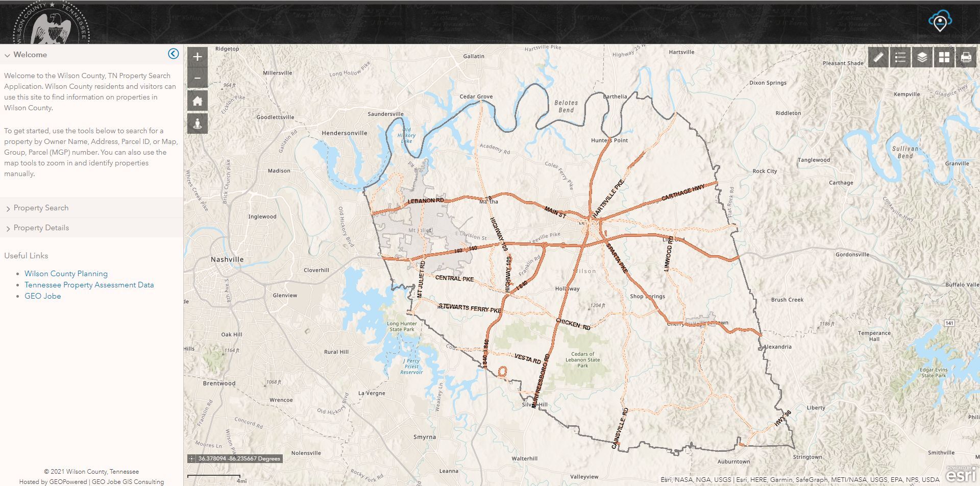
The GEO Jobe Property Search Application can provide your organization with a fully hosted, web based solution for property searching, supplying your citizens with a valuable resource to help search for and identify properties within your community.
Application Details
The Property Search Application by GEO Jobe is a fully hosted web solution powered by ArcGIS® Enterprise. This
application provides you and your citizens with a high-performance property search application supported by Esri’s
latest server and Web GIS technologies. Each application is configurable based on your data and tailored to provide
key property results and custom print layouts.
Services
Solution packages for the Property Search Application are tiered based on population. Each package includes the
setup and configuration of the application, initial data transfer, service setup, and web configuration. Additionally,
each package includes an allotment of support and general GIS service hours to support content updates as your
data changes over time.

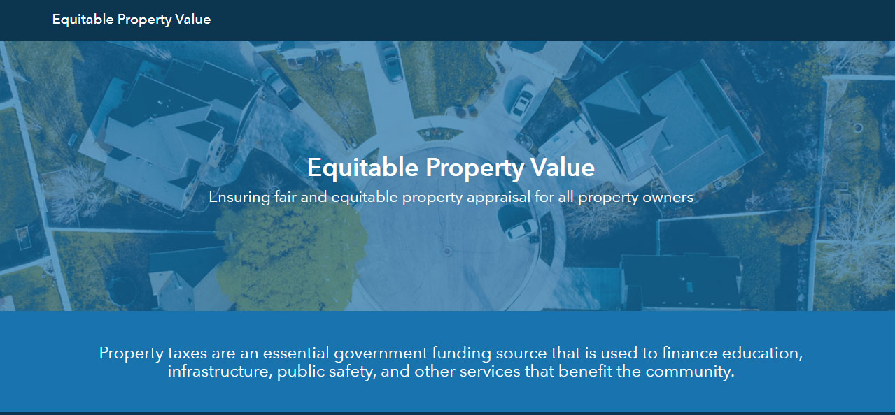
Equitable Property Value
The Equitable Property Value solution for ArcGIS Hub addresses the challenges of sharing property information and engaging the community through Esri’s ArcGIS Hub platform. The solution makes property information available in an easy to navigate application that is accessible and encourages collaboration to educate taxpayers.
ArcGIS Hub Premium
Equitable Property Value initiative
ArcGIS Online
Annual subscription to ArcGIS Hub premium includes:
- 1 ArcGIS Online community account
- 100 Creator User Types
- 10,000 Annual Service Credits
ArcGIS Hub Launch
For the Equitable Property Value initiative we will work with you to develop your hub site. Using this key information,
we will configure your hub site to support public engagement and your organization’s needs.
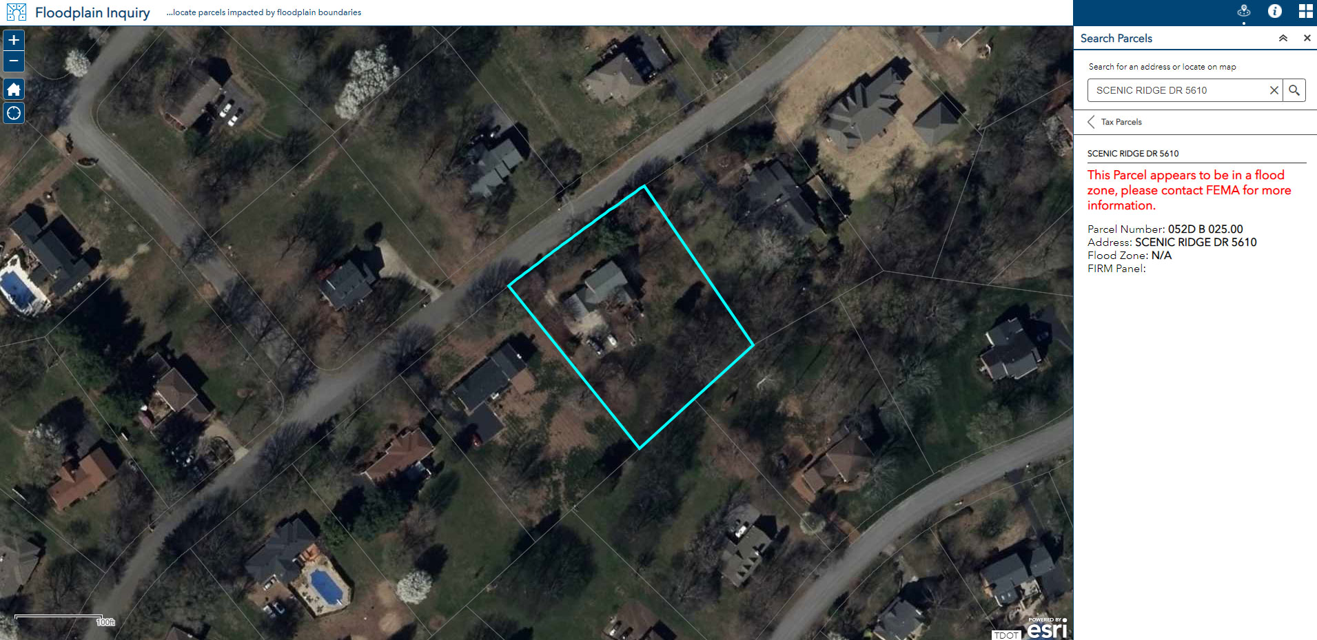
Solution Applications
Web mapping applications created in ArcGIS Online, based on available data, to support property assessment
operations and provide easy-to-use interfaces for the public. Applications include:
- Floodplain Inquiry
- Tax Parcel Viewer
- Residential Comp Finder
- Property Tax Assessment Appeal
Essential Workflow Applications
Key applications that aid in powering the solution and
soliciting feedback from the community.
- ArcGIS StoryMaps
- ArcGIS Survey123
- ArcGIS Open Data
- ArcGIS Dashboards
- ArcGIS Community Analyst
Knowledge Transfer
Once the solutions are ready for use, we will train you on best practices for maintenance and administration.
Public Works
What does GEO Jobe offer for Public Works?
Public Works departments are leading organizations in adopting GIS, modernizing how they manage their systems and data. Utilizing GIS leads to improved decision-making, increased productivity, streamlined workflows, reduced costs, and faster adaptation to evolving community needs. For Public Works, GEO Jobe partners with organizations to meet you where you are in terms of what will be most impactful to your department.
To accomplish this, GEO Jobe exclusively focuses on using the ArcGIS suite of technology provided by Esri, the world leader in geospatial technology and solutions. Working alongside our GIS professionals, we ensure that you have the best technology and resources available to accomplish your GIS objectives.