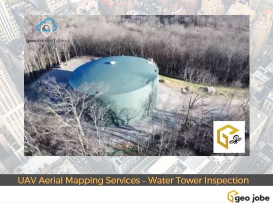
logo logo
  • Contact Us
  • About Us
    • Social Media
    • Careers
  • Enterprise/GIS
  • UAV Services
  • Products
    • Admin Tools
    • Backup My Org
    • Clean My Org
    • Scheduler for ArcGIS
    • Mapfolio
    • Web Maps for WordPress
    • security.manager NEXT
    • Knowledge Base
  • Custom Software Development
  • MapThis! Blog
    • Subscribe to Updates
    • Case Studies
  • MapThis! Shop

Tag: facilities

uav aerial mapping services

Geo Jobe GIS Consulting UAV Aerial Mapping Services – Water Tower Construction Inspection

Posted by gletham, February 14, 2017May 2, 2024

During the winter 2016/2017, Geo Jobe GIS Consulting UAV aerial mapping services were selected to provide asset inventory aerial inspection and mapping of the HB&TS – Hillsboro, Burwood & Thompson’s Station Utility District – WaterTank (Tennessee). Imagery and video was captured via UAV mission pre, during, and post construction.

READ MORE

  • Twitter
  • Facebook
  • Linkedin
  • Youtube
  • Instagram
  • Careers
  • MapThis!

© GEO Jobe (1999-2025). All rights Reserved.
Finely crafted by Proof Branding.

badge-marketplace badge-localgovernment badge-fedsmallbusiness badge-hub esriPlatinumPartner AWS Partner
UAV Information Request