Catch some sun while taking your GIS knowledge to the next level with advanced mapping technology and cutting-edge apps at Esri’s 19th Annual Developer Summit! On March 12-15th, DevSummit will bring together Esri’s global developer community in the beautiful Palm Springs, California.

Registration
DevSummit offers both in-person and virtual attendance options. Participate in various sessions of your choice, and connect with a global GIS community, be it face-to-face or from the convenience of your office desk.
- In-person: Attending DevSummit in person gives you access to the entire conference, including social and networking opportunities, technical sessions, the Esri showcase, and one-on-ones with Esri tech experts.
- Full Digital Access: Joining virtually? You’ll have access to more than 30 livestream sessions between March 12-15th and 100+ recorded sessions available in April.
- Plenary Session Only: Like in previous years, attendance to the daily plenary sessions March 12-15th is free!
Have you registered for the 2024 DevSummit? Sign up here!
The Plenary
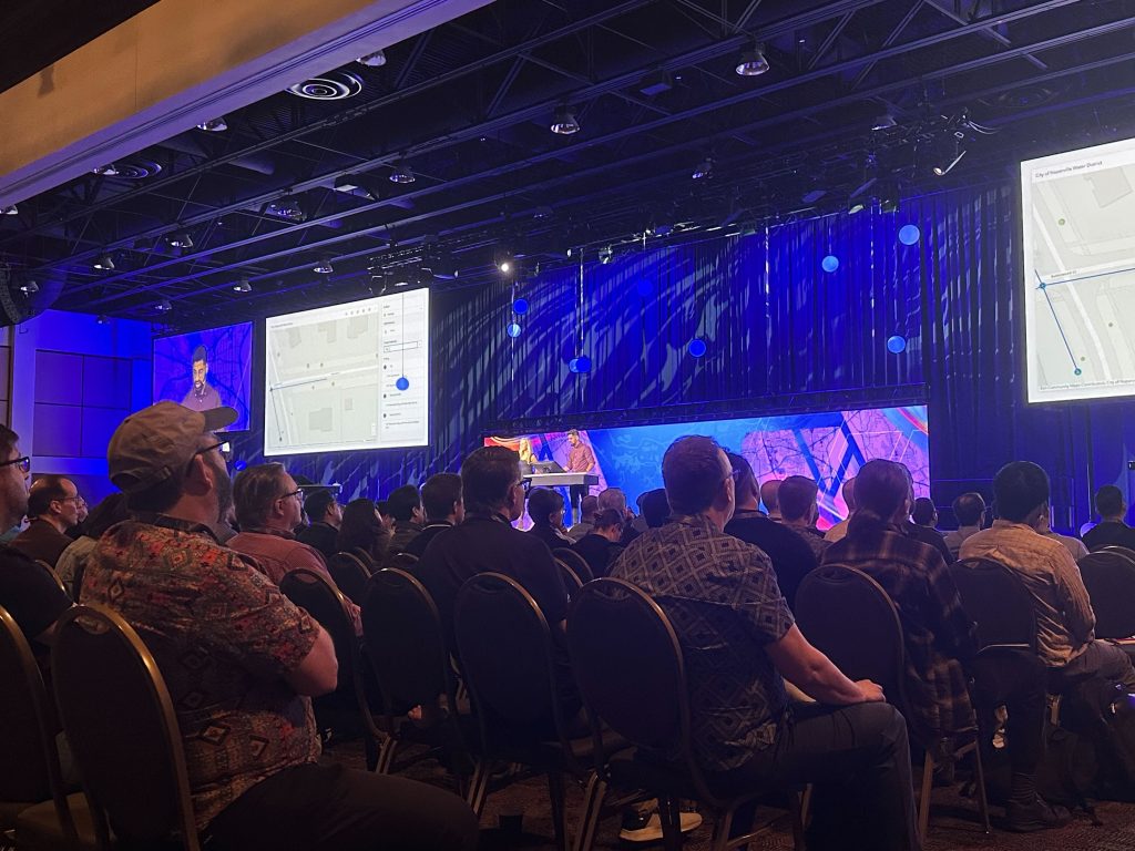
Each day of DevSummit begins with the Plenary Session. Esri President Jack Dangermond and other Esri representatives share the latest insights into geospatial development and provide demonstrations of the newest Esri technology.
- Tuesday, Mar 12th: Welcome to DevSummit
- Wednesday, March 13th: Demonstrations of New Products and Capabilities

Esri Showcase
The Esri Showcase allows you to interact with experts, discover solutions, and get the latest product and technical information directly from Esri’s experts. The showcase features:
- Esri Services: Looking for guidance from subject matter experts in the industry? Here’s your chance to gain valuable input, technical support, and more from Esri Service experts.
- GIS Product Areas: Hoping for a chance to ask Esri experts your burning questions about a product? This is it! Find answers to your workflow challenges, and see the most up-to-date product solutions.
- Esri Code Review: Seeking practical ideas about app-building from an experienced developer? Need someone to review your current code base with a pair programming session? Esri subject matter experts are on hand to offer guidance, discuss roadblocks, or explore future app ideas.
- Demo Theatres: Want to learn about tools and techniques you can apply to your own projects? These half-hour demo sessions are provided each day of the conference.
Recommended Live Sessions
When it comes to sessions, DevSummit offers more than enough to choose from. We recommend reviewing the detailed agenda to find out what sessions will work best for you. Below are sessions we recommend based on the technology you are interested in learning more about. All times are listed in Pacific Standard Time (PST).
The Road Ahead
Curious to know what the future holds for ArcGIS Pro or ArcGIS Enterprise? These sessions provide insight into release plans for various products, as well as demos of some new capabilities.
- ArcGIS Pro: The Road Ahead – Tuesday, March 12, 2:30 PM – 3:30 PM
- ArcGIS Field Apps: The Road Ahead – Wednesday, March 13, 10:30 AM – 11:30 AM
- ArcGIS Maps SDK for JavaScript: The Road Ahead – Thursday, March 14, 2:30 PM – 3:30 PM
- ArcGIS Maps SDKs for Native Apps: What’s New and the Road Ahead – Thursday, March 14, 4:00 PM – 5:00 PM
- ArcGIS Enterprise: The Road Ahead – Thursday, March 14, 5:30 PM – 6:30 PM
- Calcite Design System: What’s New and the Road Ahead – Thursday, March 14, 5:30 PM – 6:30 PM
ArcGIS Enterprise
- ArcGIS Enterprise: An Introduction for Developers – Tuesday, March 12, 1:00 – 2:00 PM
- ArcGIS Enterprise: Integrating Cloud Native Services – Tuesday, March 12, 2:30 PM – 3:30 PM
- Extending ArcGIS Enterprise with Webhooks – Tuesday, March 12, 4:00 PM – 5:00 PM
- ArcGIS Enterprise: Automation with Hosted Notebooks – Wednesday, March 13, 10:30 AM – 11:30 AM
- ArcGIS Enterprise on Kubernetes: Wreck It and Recover It – Wednesday, March 13, 4:45 PM – 5:15 PM
- GIS Auditor – An Automated System for ArcGIS Enterprise Users and Contents Audit – Wednesday, March 13, 4:45 PM – 5:15 PM
- Streamlining ArcGIS Deployments: Fueled by DevOps (and Chicken) – Thursday, March 14, 1:45 PM – 2:15 PM
- Using AWS Serverless Architecture for Hosting Static Web Mapping Applications – Thursday, March 14, 1:45 PM – 2:15 PM
ArcGIS Online
- Data Pipelines: Empowering Developers for Data Engineering – Tuesday, March 12, 2:30 PM – 3:00 PM
- ArcGIS Online and ArcGIS Enterprise: Architectural Patterns and Practices – Wednesday, March 13, 2:30 PM – 3:30 PM
- ArcGIS Online: Web Mapping with Arcade Expressions – Wednesday, March 13, 10:30 AM – 11:30 AM
- Working with Hosted Feature Layer Views and Public Data – Wednesday, March 13, 4:00 PM – 5:00 PM
- ArcGIS Online: Latest Techniques for Building Web Apps Using Web Maps – Wednesday, March 13, 5:30 PM – 6:30 PM
- ArcGIS Online: Best Practices for Publishing and Maintaining Large Datasets – Thursday, March 14, 4:00 PM – 5:00 PM
Field Applications
- Advanced Survey123 XLSForm Expressions – Wednesday, March 13, 2:30 PM – 3:00 PM
- Unleashing Mobile Power: From Out-of-the-Box to Custom App Development – Wednesday, March 13, 4:00 PM – 5:00 PM
- ArcGIS Survey123: How to Create an AI Smart Assistant – Thursday, March 14, 2:30 PM – 3:30 PM
- ArcGIS Field Maps: Advanced Workflows with Arcade – Thursday, March 14, 4:00 PM – 5:00 PM
- Field Maps: Integration & Automation – Friday, March 15, 10:00 AM – 11:00 AM
ArcGIS Platform
- Best Practices When Developing with SaaS and PaaS – Tuesday, March 12, 1:00 PM – 2:00 PM
- Building Location-Aware Applications for Various Use Cases – Tuesday, March 12, 2:30 PM – 3:30 PM
- Build Applications with Data Services – Tuesday, March 12, 5:30 PM – 6:00 PM
- Security and Authentication for Custom Applications – Tuesday, March 12, 5:30 PM – 6:30 PM
- Front-End Web Technologies for Geospatial Developers – Wednesday, March 13, 10:30 AM – 11:30 AM
- License Esri PaaS, SaaS, Software: Common Patterns and Architectures – Wednesday, March 13, 10:30 AM – 11:30 AM
- Build Applications with the Geocoding Service – Wednesday, March 13, 1:00 PM – 1:30 PM
- Build Applications with the ArcGIS Routing Service – Wednesday, March 13, 1:45 PM – 2:15 PM
- Civic AI Assistants – Thursday, March 14, 1:45 PM – 2:15 PM
ArcGIS API
- Managing Imagery Layers Using the ArcGIS API for Python – Tuesday, March 12, 1:00 PM – 1:30 PM
- Mapping and Exploring Spatial Data in Jupyter Notebooks – Tuesday, March 12, 4:00 PM – 4:30 PM
- Service Integration for Application Developers with ArcGIS REST JS – Thursday, March 14, 4:00 PM – 5:00 PM
- ArcGIS REST API: An Overview of the Utility Network Service and Related Services APIs – Thursday, March 14, 1:00 PM – 2:00 PM
- An Introduction to JavaScript for Future Web Developers – Wednesday, March 13, 1:00 PM – 1:30 PM
Miscellaneous
- Strategies for Scripting and Automating – Tuesday, March 12, 2:30 PM – 3:30 PM
- ArcGIS Connectors for Power Automate – Tuesday, March 12, 1:00 PM – 2:00 PM
- License Esri PaaS, SaaS, Software: Common Patterns and Architectures – Wednesday, March 13, 10:30 AM – 11:30 AM
- Building Web Apps with ArcGIS Maps SDK for JavaScript and Calcite Design System – Wednesday, March 13, 1:00 PM – 2:00 PM
- Extended Reality (XR) in ArcGIS – Wednesday, March 13, 2:30 PM – 3:30 PM
- Arcade in ArcGIS Dashboards – Wednesday, March 13, 4:00 PM – 5:00 PM
- Designing and Implementing Well-Architected Systems – Thursday, March 14, 4:00 PM – 5:00 PM
- Advanced Open Source Mapping Libraries with ArcGIS Location Services – Friday, March 15, 8:30 AM – 9:30 AM
Want to set-up a meeting with our team to discuss solutions for your organization? Contact us at connect@geo-jobe.com, or call 1-844-GEO-JOBE to discuss how we can help!
About GEO Jobe
GEO Jobe is a leading GIS software and geospatial solutions provider, serving over 10,000 organizations globally. GEO Jobe is best known for developing the most popular applications in the ArcGIS Marketplace, including Admin Tools for ArcGIS, Backup My Org, Clean My Org and Scheduler for ArcGIS.
GEO Jobe offers U.S.-based 24/7 Support solutions for organizations using Esri’s ArcGIS© System. GEO Jobe also offers professional services focused on Esri’s ArcGIS© System, including custom software development, enterprise solution implementation, data science and UAV data collection.
Founded in 1999, GEO Jobe is in its 25th year of operation, has been an Esri business partner since 2002 and is currently a Platinum Partner.


