Image courtesy Pixabay
Find a seat and grab some popcorn, because we are going to talk about how GIS (Geographic Information Systems) has been utilized and referenced in movies and TV!
When I was given the opportunity to write another article for our blog, I knew exactly what I wanted to write about. Many of us are familiar with the use of GIS in infrastructure, surveying, etc. but not so much when it comes to more recreational uses.
So let’s take a look at some movies together, and hopefully you will find these as interesting and useful as I did!
What We Do in the Shadows
First, let’s start with a pretty direct nod to the GIS community. On Hulu, there is a popular movie called What We Do in the Shadows, where Stu is trying to explain what GIS is to other characters in the show. I think many of us can relate to trying to explain GIS to non-GIS people, and how spot on Stu’s portrayal is, especially once you learn some of what was going on behind the scenes.
See, Stu Rutherford, the actor who plays Stu, was essentially told to portray himself rather than act like somebody else, leading to the very amusing, and often awkward, interactions within these scenes. Long story short, I found these interactions hilarious and definitely amusing enough to make me want to watch the entire movie.
Zootopia
Another film that is fairly well known with a very cool behind-the-scenes connection to GIS, is Zootopia. Yep, the popular Disney film relied on GIS technology to create the city that is the setting for the whole story. Disney has actually involved GIS in many of their world-building projects, and it’s just so cool to see how the tools we use to solve real-world problems can also help bring our stories to life!
If you really want to learn more in depth about how it was all done, I highly recommend checking out this video from the Esri UC 2017, where Brandon, a technical director at Disney, goes over how it was all done!
Le Samouraï
Now, let’s take a look at a movie a bit further back—one that I had never seen or heard of before I started researching this article. It is a French film called Le Samouraï, released in 1967. At one point, the police are attempting to track the main character, hitman Jef Costello.
To do so, they use transmitters to relay their positions as they track him, which then light up bulbs on the map in the police station where they are coordinating the capture efforts (You can see it in action at the 1 hour, 25 minute mark of the movie). I have included the trailer for the remastered version of the movie, so check it out when you have the time!
The District
Many, and I mean MANY, crime shows feature GIS tools, but there is one in particular that took it the extra mile. From 2000 to 2004, there was a TV show called The District. It utilized many of Esri’s tools, such as ArcView GIS and ArcView 3D Analyst, and had Esri themselves assist with creating realistic crime maps for the series.
Check out this article from Esri where they go over the work in detail. It was fascinating to see the amount of detail that was put into this show.

An image of Washington D.C., where The District takes place. (Image from Pixabay)
The Banshees of Inisherin
Finally, here is one I have not seen yet. I came across this article while researching, and it has made me interested in the movie, The Banshees of Inisherin. Since I have not seen this one, there’s not much insight for me to offer beyond the article itself, but I hoped it would give most of us something new to check out.

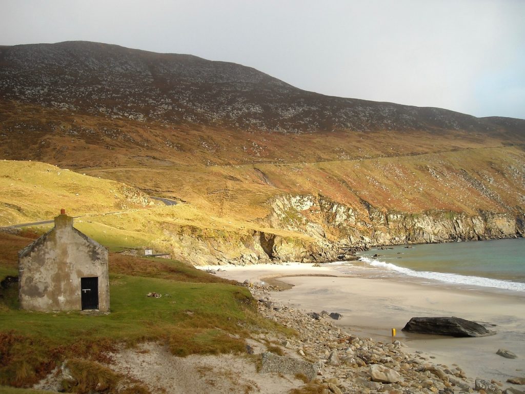
An image from Achill, Ireland, one of the areas that data was collected for The Banshees of Inisherin. (Image by Sharon Fisher from Pixabay)
There are many, many more uses of GIS in film, but these were some of the ones I found to be more diverse and interesting. If any of these were interesting to you as well, or if you have your own recommendations, reach out to me on LinkedIn and let me know. I’d be excited to see what you all think and recommend!
Interested in more from GEO Jobe? Explore these other MapThis! articles:
- GEO Jobe on the Road in 2025
- 25 Years of GEO Jobe: Mapping a Legacy of Innovation & Community
- The Rise of UAVs: Transforming the Cinematic Landscape
- Why Winter is the Best Time for Capturing Aerial Data
- Q&A with GEO Jobe’s Customer Success Manager Tony Saracino
- Crisis to Coordination: How Local Governments Harness GIS
- Game Throughout the World with GIS

About Our Company
GEO Jobe is a leading GIS software and geospatial solutions provider, serving over 10,000 organizations globally. GEO Jobe is best known for developing the most popular applications in the ArcGIS Marketplace, including Admin Tools for ArcGIS, Backup My Org, Clean My Org and Scheduler for ArcGIS.
GEO Jobe offers U.S.-based 24/7 Support solutions for organizations using Esri’s ArcGIS© System. GEO Jobe also offers professional services focused on Esri’s ArcGIS© System, including custom software development, enterprise solution implementation, data science and UAV data collection.
Founded in 1999, GEO Jobe is in its 25th year of operation, has been an Esri business partner since 2002 and is currently a Platinum Partner.


