If you work in a GIS or Engineering field, you are likely incredibly familiar with either CAD or GIS, but behind the curve when it comes to the other. This makes sense and is completely understandable when your work focuses more on one program. CAD, or Computer Aided Drawing, is a program used by a variety of professionals, including architects and engineers, but only tangentially by people in the GIS world. The case for integrating the two, or even transitioning data from CAD into a GIS, is strong for several reasons. Below, I will discuss the benefits of making this switch to GIS.
Spatial Component
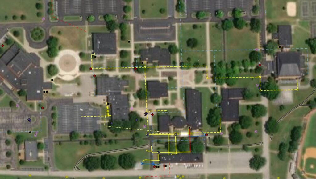
The biggest difference between CAD and GIS is, of course, the inherent spatial component of GIS. While architects and engineers draw to scale, their drawings are not always tied to a coordinate system. If one does not exist, it can be defined in the early stages of the import-to-GIS process. The data, which now have a coordinate system, can be georeferenced on a map to line up exactly with the physical features. Our clients have found this especially useful for water and gas lines on their properties. Once feature classes are created from the drawings and placed in a database or folder, the data can be utilized to its full potential in maps and apps by people who need access to the information.
Improved Data Organization
Through working with clients who are making the move from CAD to GIS, I have learned that their data are typically less organized than they may like it to be. The drawings they rely on are often-times old printouts that have been stored in filing cabinets with no real organization. Now, this may not always be the case, but when it is, transitioning to GIS is a major benefit. It allows you to compile digitized features into one database and makes querying large datasets quick and easy.
Accessibility, Distribution, and Data Collection
As previously mentioned, physical copies of CAD data may be stored anywhere, from binders to desk drawers to under the coffee machine. None of these places are very convenient when they need to be referenced by any number of field crews and managers at the same time. GIS makes it possible to publish services that contain the data, create maps, and share them with your organization. Say you are managing a water system and only have a pile of drawings to base decisions on. If a field worker needed to know exactly where a line was, it would be incredibly difficult and time-consuming to communicate the exact location from the drawing.
With GIS, a fieldworker can pull up a digital map on their phone and use the GPS on the device (or a more accurate external GPS unit) to navigate to the features of interest, ultimately improving efficiency and accuracy. In the end, it leads to teams working more cohesively, since they can all access the same data simultaneously. When it comes to data collection, this is very important. Field crews can now have the converted CAD data in the palm of their hands instead of referring to an antiquated physical “map” that lacks spatial information.