Further your GIS knowledge with Esri MOOCs and more!

The GIS field is a vast field with multiple specializations and consistent new developments. While a GIS analyst may be specialized in one area, they may not be aware of features in another area, or even how new developments may apply to their field. One way for those in the field to keep up with developments while expanding knowledge is through online courses.
There are a variety of courses available that range from do-at-your-own schedule to live and scheduled. Some of these courses are paid and some are completely free. If you use the Esri Ecosystem as part of your daily workflow, Esri makes it easy to take classes, and most of their offerings are either free or part of an active maintenance license.
Among these offerings are Massive Open Online Courses (MOOCs), which are classes that run between four to six weeks, with a new topic covered each week. To get the certificate at the end of the class, you must have completed all assignments during the course’s timeframe. The free offerings from Esri include their self-paced trainings, which are courses that you can start and take at your own pace.
The following sections go more in-depth for each type of training, along with a few suggestions for classes.
Esri’s MOOCs
The first free Esri offerings are Esri MOOCs. As previously mentioned, these MOOCs run four to six weeks, and the course and associated material must be completed within a certain timeframe to receive the certificate. Course requirements and weekly time commitments vary slightly.
In general, each week will have a video lesson, a tutorial and questions to answer. The tutorial includes a basic walkthrough for an end product, and then stretch goals that are similar to what was covered in the tutorial, but may ask for a different analysis type or different output.
There are also forums that the participant can use to ask questions about issues they are running into or ask for feedback. Each MOOC also gives access to an ArcGIS Pro license for the week of the course, as well credits needed for any ArcGIS Online analysis.
At the time this article is being written, Esri offers six MOOCs that cover a variety of topics, from spatial analysis to using GIS in architecture and engineering projects. The following is a more in-depth look at two of the MOOCs that I have taken and enjoyed.
Spatial Data Science: The New Frontier in Analytics
(Author Enrolled in Fall 2022 Course)
The Spatial Data Science course “……explores the application of spatial data science to uncover hidden patterns and improve predictive modeling” through the use of ArcGIS software and different open data science packages. Minimal coding knowledge is required to complete the course, though it is helpful. The course walks through multiple deep learning tools within ArcGIS, including pre-loaded tools, how to use notebooks, and how to bring in pre-trained deep learning models from ArcGIS Living Atlas for scenarios such as detecting pools in imagery.
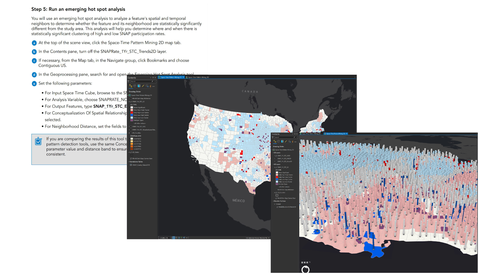
A snippet of a walkthrough and some of the outputs for the 2D and 3D mapping of time variables in the Spatial Data Science MOOC course.
Imagery in Action
(Author Enrolled in Fall 2023 Course)
The Imagery in Action MOOC is for learning “…..about the uses of imagery…and growing integrations of imagery with GIS.” The course is set up for both those who have minimal experience with imagery and those who have a background in imagery but not with analysis within the Esri Ecosystem. The course goes through deep learning based classification in both ArcGIS Pro and on ArcGIS Online, creating and using raster function templates, and even using ArcGIS Drone2Map to create an orthomosaic and 3D model.
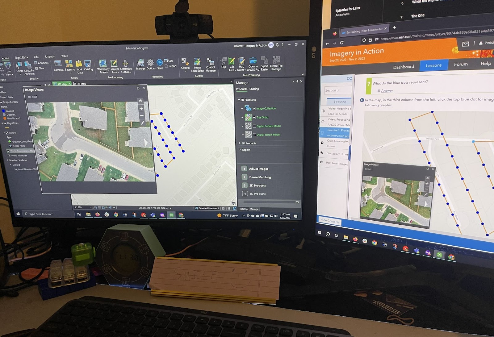
A view of working in drone2map to create the orthomosaic and the walkthrough by Esri. Apologies for the old fashioned picture of a screen in lieu of a screenshot.
Next MOOC Offering
The next MOOC offering from ESRI to start is Cartography and runs from April 3, 2024 – May 15, 2024. To register, you need a MyEsri account and profile (free to create if you do not already have one). You can register here.
Esri’s Self-Paced Web Courses and ArcGIS Labs
Another of Esri’s free training types are their self-paced offerings, which include Web Courses and ArcGIS Labs. Both can be started at any point in time and you can take as long as you need to complete them. Both are similar with tutorials and mini-quizzes, but ArcGIS Labs put more emphasis on the hands-on learning and typically only take one to two hours.
To be able to complete the tutorials and workflows in either of these courses, you must already have the appropriate licenses and will also utilize credits with online workflows. The following are selections of courses (of both types) that I have taken and enjoyed for various reasons.
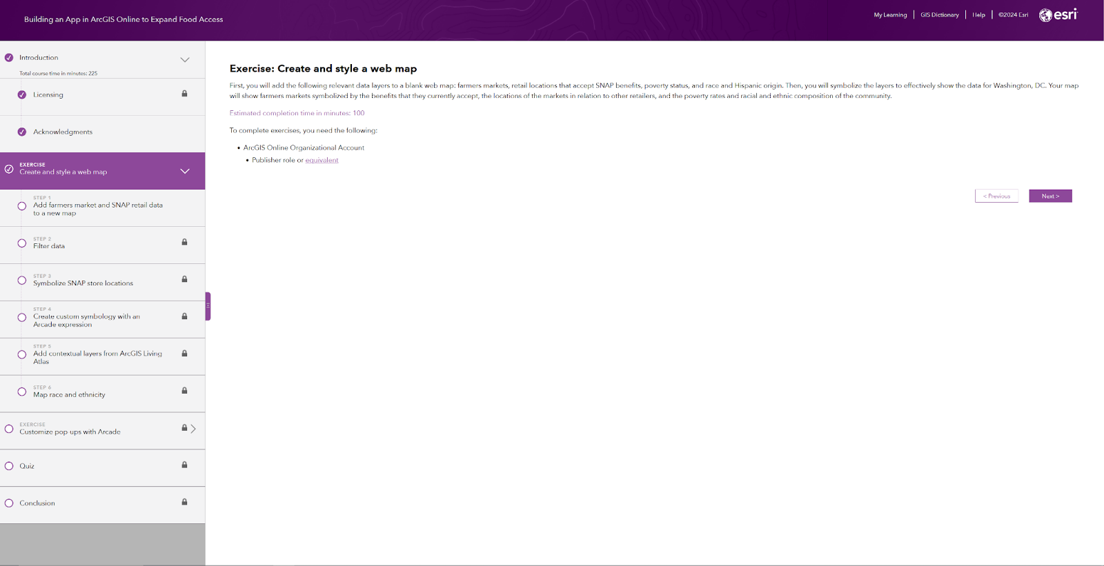
An overview of the layout for an ArcGIS Lab
Building an App in ArcGIS Online to Expand Food Access
(Author completed course in Spring 2023)
This ArcGIS Lab is a walkthrough tutorial to create an interactive web app for Farmer Market access in Washington, D.C. The first part of the exercise is creating the web map and layers to the map, filtering data, and symbolizing the data using Arcade.
The second part of the lab goes through using ArcGIS Arcade to customize pop-ups. The lab is set up for all experience levels, though some familiarity with Web Maps may be helpful. The labs also act as a good introduction to ArcGIS Arcade if you have not used it before.
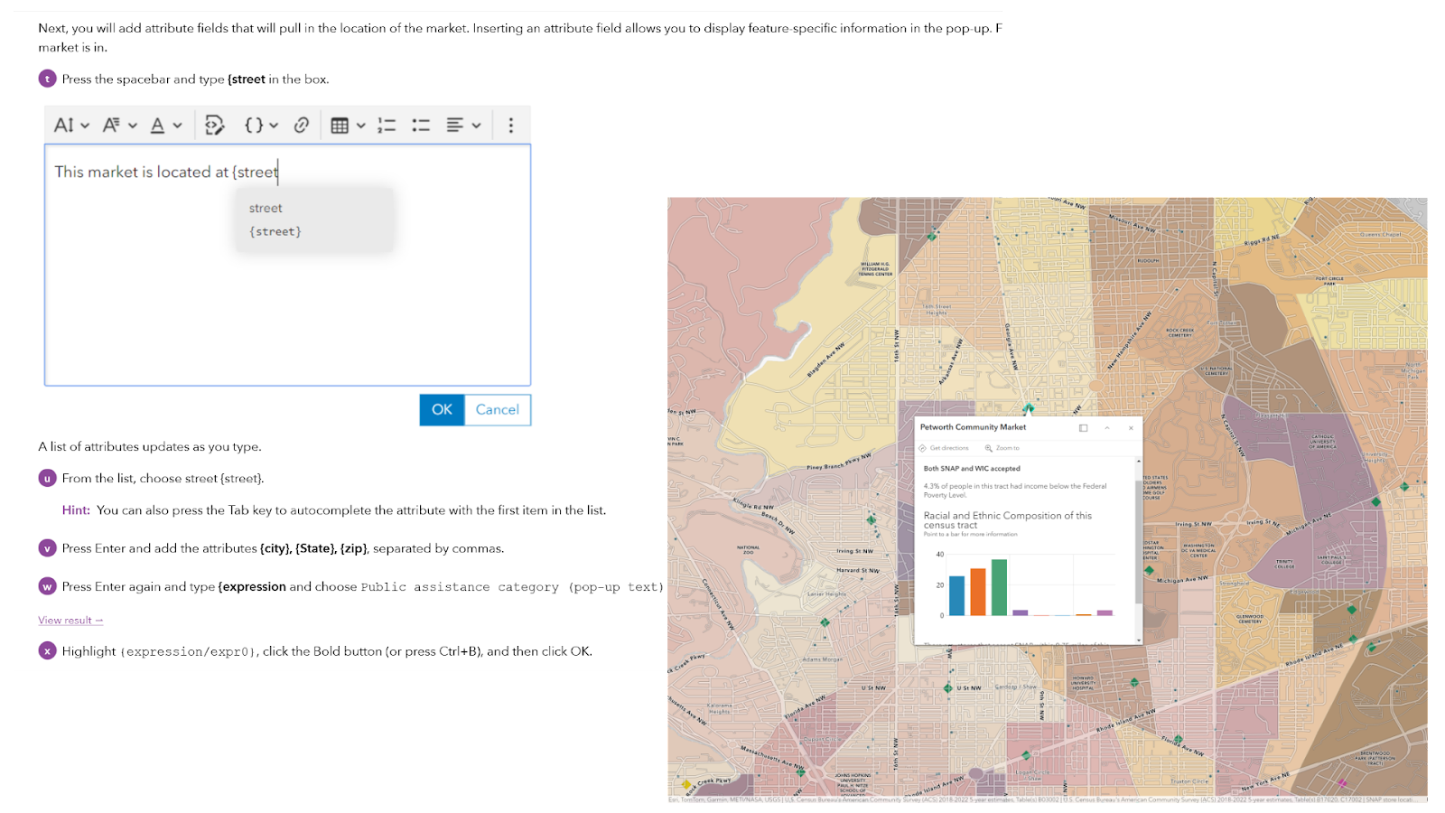
A view of the Building an App in ArcGIS Online to Expand Food Access lab that includes a portion of the ArcGIS Arcade Script to help format the pop-up and the completed web map with the formatted popup.
(Author completed class in Fall 2023)
The ArcGIS Pro Basics web course is designed to introduce people to ArcGIS Pro who have never used the program before. The course starts with an overview on the basic user interface of ArcGIS Pro and what the components are called and then switches to opening a project and displaying different types of data.
The course is quick, clean, and introduces a new program in an easy way to understand for those who are not familiar with it. It is also a good course to take if you need a refresher on anything, especially with the components of the user interface.
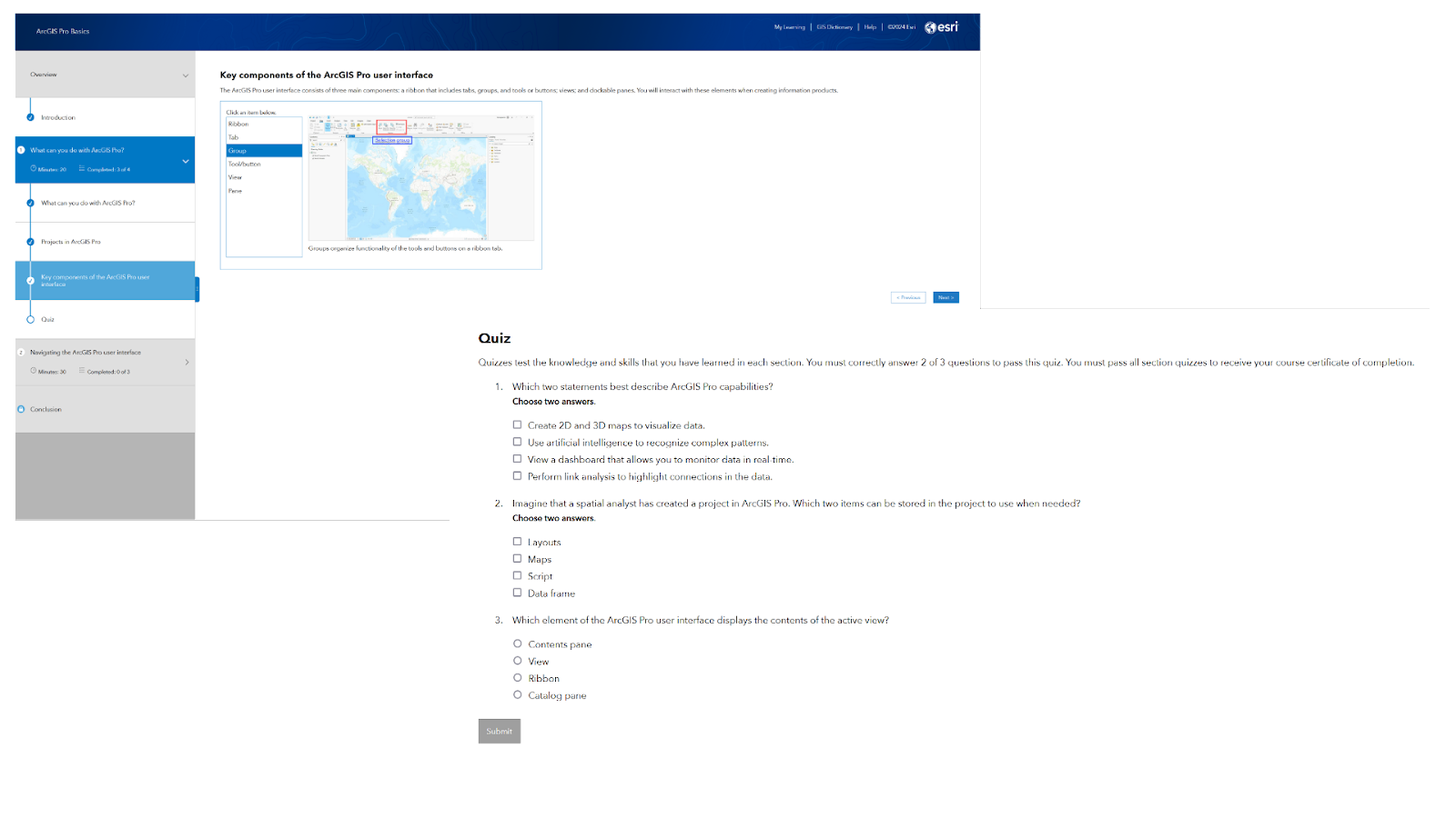
A view of the ArcGIS Pro Basics web course, including an overview of the web course layout, a portion of the course interactive lectures, and a quiz.
More Self-Paced Courses
The above are just a select few offerings from the many courses available that I have taken and enjoyed. You can search for available courses from Esri here. Just make sure that in formats, you select Web Course or ArcGIS Labs if you want free (or part of your current maintenance subscription) interactive courses. There are also other formats available, such as videos or story maps.
Conclusion
Continuing education and learning is an important part of staying relevant in the GIS field. This article gave a quick overview of the many available from Esri, including their MOOCs and their on-demand Web Courses and ArcGIS labs. However, these are just a small amount of free (or cheap) offerings that can be found across the web.
Be sure to check out everything Esri is offering, but also check out places like our MapThis blog for tutorials, find channels on YouTube, or browse through GIS posts on LinkedIn. There are sources everywhere to help you expand your development in the GIS field.
As a very wise fortune cookie once said…

About GEO Jobe
GEO Jobe is a leading GIS software and geospatial solutions provider, serving over 10,000 organizations globally. GEO Jobe is best known for developing the most popular applications in the ArcGIS Marketplace, including Admin Tools for ArcGIS, Backup My Org, Clean My Org and Scheduler for ArcGIS.
GEO Jobe offers U.S.-based 24/7 Support solutions for organizations using Esri’s ArcGIS© System. GEO Jobe also offers professional services focused on Esri’s ArcGIS© System, including custom software development, enterprise solution implementation, data science and UAV data collection.
Founded in 1999, GEO Jobe is in its 25th year of operation, has been an Esri business partner since 2002 and is currently a Platinum Partner. To learn more about the company’s variety of GIS products and services and how we could support your organization, email GEO Jobe at connect@geo-jobe.com.