


The City of Winter Park is a suburban city in Orange County, Florida and is part of the Orlando-Kissimmee Metropolitan Statistical Area. Winter Park is the city of arts and culture, cherishing its traditional scale and charm while building a healthy and sustainable future for all generations.
Like many municipalities, Winter Park faced a challenge in managing access to its GIS data. With over 30 different departments involved in work order management, and each of those departments needing access to GIS data via web apps for in-the-field tasks, Winter Park’s GIS team had a potentially large number of services and apps to manage, just to allow each department to do its job. The GIS team at Winter Park sought out a more elegant solution that would reduce the number of maps and apps required to support the city’s workflows, while making management of spatial data considerably more efficient, saving time and taxpayers’ money.
“security.manager doesn’t just make things easier, it makes things possible.” Keith Gerhartz, City of Winter Park
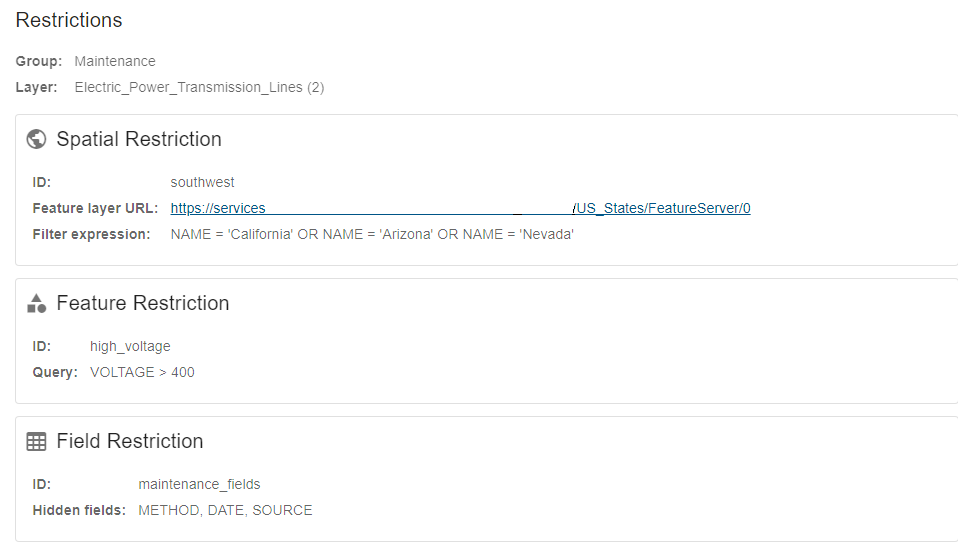
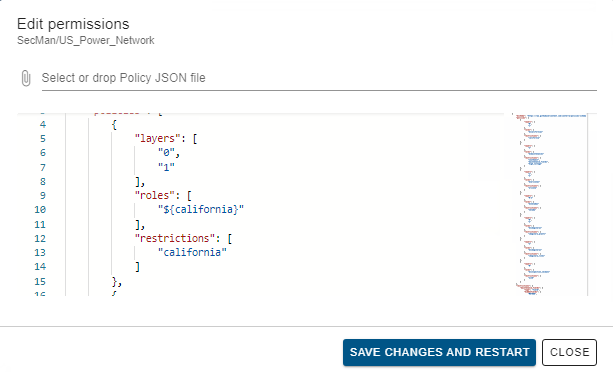
The City of Winter Park began using security.manager to implement fine grained control over department-centric ArcGIS Web AppBuilder applications. While these applications can be accessed by any city employee, users should only see data that they have been granted access to. This is achieved by using security.manager to create security roles that mirror the activities to which staff are assigned. For example, if someone’s duties are limited to collecting hydrant flow data, then the GIS Administrators can create a role called “Hydrant Flow Inspector” and limit edit access for that role to a single layer.
The city has also extended its use of security.manager to implement a truly centralized work order management system. All work requests are recorded and managed in a single database, regardless of whether it is a citizen submission, an interdepartmental request, or a work activity that is internally generated within a department. Security roles are established by department and function to ensure that work is properly routed, and that users can only edit data that reflects their role in the workflow. For example, a citizen can submit a request that is forwarded to a customer service manager. The manager then routes the request to the appropriate department dispatcher who, in turn, assigns the work to staff. Staff then updates the record upon completion. security.manager is used at every step in this process to control what people in each of these roles can do. The work orders layer is added to each departmental Web AppBuilder app to create a fully integrated operational environment. This would not be possible without the functionality that security.manager offers.
security.manager enabled the GIS team to create one map service to serve all departments, and to control how each app behaves by simply establishing user roles. Without security.manager, such fine-level control would only be obtainable by creating a large number of map services (non-federated), or web maps (federated), and a corresponding number of apps to utilize these services. By utilizing security.manager, Winter Park was able to reduce the number of map services and apps required for the work order management from 31 to 1, a result that clearly demonstrates improved control and functionality, as well as reduced costs.
“Without security.manager we would only be able to achieve fine level control by creating a large number of apps and a large number of map services or web maps. The end result has been improved control and functionality with reduced cost.” Keith Gerhartz, City of Winter Park
If you are interested in learning more about con terra’s security.manager please contact us at connect@geo-jobe.com and we would be happy to answer any questions.
