The annual International Esri User Conference (Esri UC) took place virtually July 13-16, 2020. To say that there was a LOT of new technology and capabilities announced at the 2020 Esri UC is likely an understatement!
Obviously we can’t cover everything in a single blog post, but, we can touch on some of the cool and widely praised (and discussed) new tech that was shared. So, let’s look at a few of the most recent, new technologies from Esri, beginning with a quick list of what’s new ArcGIS Pro 2.6.
New in ArcGIS Pro 2.6
With the latest release of ArcGIS Pro 2.6 there’s a number of new additions and capabilities that users can take advantage of.
- A new topology web feature layer in the GeoDatabase. This enables users to bring topology into a map as a feature service (or web layer).
- Create read only to your tabular data through OLE DB.
- Data stored in GeoPackages are now fully editable (this also includes undo and redo capabilities).
- A new network solution, the trace network, a path to ArcGIS Pro to model your network or perform advanced analytics.
- Voxels & 3D volumetric visualizations (ideal for geological models, atmospheric and oceanographic data).
- Link charts enable users to create, manage, and visualize relationships between entities.
- ArcGIS Pro now creates a backup file for unsaved changes in your work – no more lost work due to a system crash!
Please note, the release of 2.6 should come sometime late in July 2020. You are encouraged to learn more about this release in this video.
An update to the 3D Scene Viewer
There’s no question that 3D is hot! For those looking to make a splash or really WOW others with their work, then sharing the results of spatial analysis in 3D or a 3D viewing environment is the solution. Recall, Scene Viewer is the solution for ArcGIS users to combine 2D and 3D data products in order to tell a story in 3D.
At UC 2020, Esri product leads shared details of the newest additions to Scene Viewer as of June 2020. Perhaps most noteworthy was the additional support for integrated mesh modifications in ArcGIS Pro. The integrated mesh data type are created using tools like Drone2Map or SiteScan. Other cool new features included in this latest update include a reflective water style for a realistic water effect, enhanced shadow mapping, and additional 3D polygon labeling.
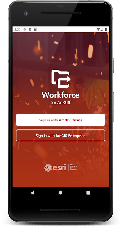
Cool Technology – ArcGIS Workforce
Every User Conference has some “wow” technology that is announced – that moment when the crowd is silent, then moments later they break out in a huge round of applause and whistles! One of those moments this year could have been when details of Workforce for ArcGIS were shared. While the final Beta was announced in May, and released in July, many users had not learned about Workforce until the UC.
So, what is Workforce? Simply put: “Workforce is included with ArcGIS. Inside of your ArcGIS organization, you can use the Workforce web app to create projects that include the definition of work that needs to be completed and the mobile users that will be assigned to complete it.”
Most recently, the most sought after updates to Workforce support working offline and organizing your content into a project consisting of a single feature layer that contains 2 layers and 3 tables.
Are you interested in becoming an early adopter? If so jump to sign up here!
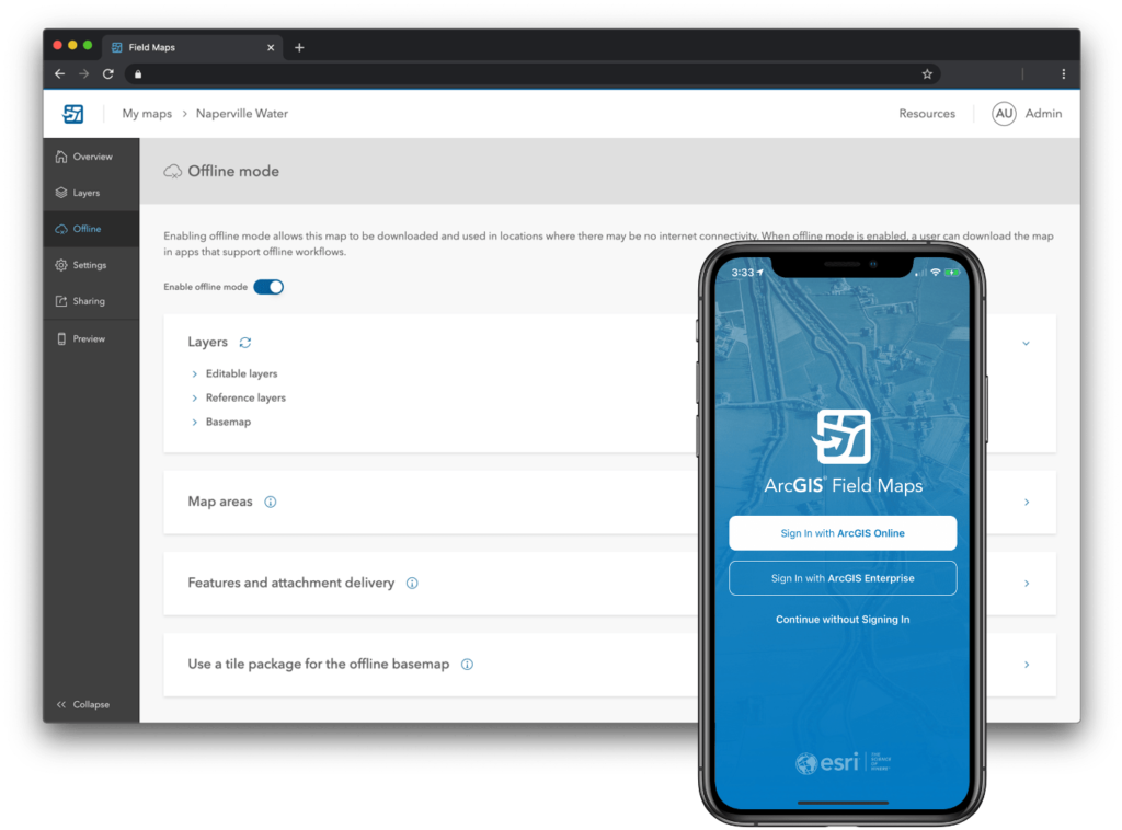
NEW – ArcGIS Field Map
Speaking of mobile technology, another topic that turned heads at ESRIUC was ArcGIS Field Maps. ArcGIS Field Maps is Esri’s new maps app on iOS and Android devices that combines map viewing and markup, field data collection, location tracking, work planning, task management, and turn-by-turn navigation into a single app! According to Esri’s Jeff Shaner, Field Maps will include a new web app, integrated with ArcGIS, that can be used to configure and deploy maps optimized for your mobile workforce needs – this sounds like it’s going to be very well received! Learn more about ArcGIS Field Maps here.
NEW – Site scan for ArcGIS
Site Scan for ArcGIS is a cloud-based solution that provides automated drone flight planning, drone fleet management, image processing and analysis capabilities. Think of this as your complete, end-to-end solution for acquiring, processing, and analysing drone imagery!
Image processing and analysis of your autonomous flight data. Ideal for building inspection, construction project management and more. Some noteworthy features in Site Scan include:
- Data saved in the cloud for your users
- View point clouds for making 2d and 3d measurements.
- Immediately upload your data to ArcGIS Online for use throughout your organization.
- QuickMap offline photo stitching
- Geofencing

Site Scan for currently available for iOS in the Apple App Store. Licensed users can get started here, and you can learn more about Site Scan in this FAQ from Esri.
GIS Response to COVID-19 at ESRIUC
It came as no surprise to most of us that the topic of COVID-19 and the GIS industry response was a huge topic at the 2020 UC (for example, this session on crisis management) . During the event, a number of sessions, presentations and discussion surrounded the coronavirus, and in particular, how the GIS community has been responding to the pandemic.
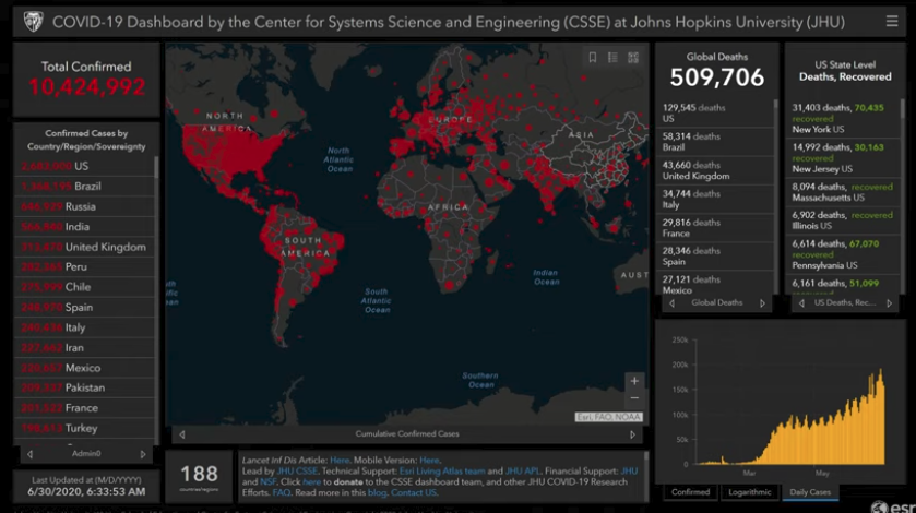
There were many sightings of the popular COVID-19 Dashboard by Johns Hopkin University during the conference, including on the mainstage plenary session. There is perhaps no better example of Operations Dashboards in use than this one which has been seen, pictured and quoted by every major news source.
To date, the COVID-19 dashboard has received more than a billion visits and in March, it was reported that the service was responding to over a billion daily feature requests! The map was first shared publicly on Jan. 22. It was developed to provide researchers, public health authorities, and the general public with a user-friendly tool to track the outbreak as it unfolds. At the 2020 UC, Johns Hopkins was presented with the Making a Difference Award by Esri President, Jack Dangermond. This annual award goes to an organization who made a positive impact on the community using GIS technology.
Please note, Johns Hopkins University is interested in working with states who are providing county case data as a feature layer, so that JHU can source from the state directly. Learn more in this Esri blog or see also this FAQ from Johns Hopkins University.
COVID-19 GIS Hub
In addition to the team at Johns Hopkins, countless other organizations, jurisdictions, and local governments are creating and sharing their own Dashboards and GIS data hubs. For example, Cobb County, GA. To assist these organizations, Esri launched the COVID-19 GIS Hub. This is the go-to portal to get maps, data, apps and more for sharing and using in your Hub. In addition to the Hub, Esri has also rolled out their COVID-19 resource where the community can access a wealth of resources to assist communities with their response and reopening.
Does your organization need assistance building and deploying a Hub? A reminder that GEO Jobe was recently awarded the ArcGIS Hub specialty designation by Esri.
New ArcGIS Pro Toolset – Time series Forecasting
New in the latest release of ArcGIS Pro, the Community contact tracing with the time series forecasting tool. This enables the modeling of time series trends in data. Several tools are included in order to detect and emphasize trends in your data to support forecasting. According to Esri, these tools allow organizations to model patterns and trends in their time series data, taking advantage of traditional and machine learning approaches. Users are encouraged to learn more in this video from the UC.
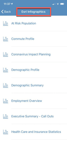
Create a COVID-19 Impact Report
Finally, at the ESRI UC, users learned more about ArcGIS Business Analyst This tool set is ideal for supporting business site selection and other crucial decision making. Most recently, Esri has shared details of how the community can use Business Analyst to run a COVID-19 planning report and generate a detailed info-graphic. The process is quite simple and taps into a wealth of data (cloud hosted) to generate a report for any area of interest using the mobile app and the newly shared report template.
Users interested in trying Business Analyst can access a free, 21 day trial or purchase a very affordable license! Learn more about the Impact Report in this blog or learn about purchase/trial information on the ArcGIS Business Analyst page.
GEO Jobe at the 2020 ESRI UC
The 2020 Esri User Conference was definitely unlike no other in the past. If anything though, the virtual format opened the conference up for all to enjoy – which was evident in the sheer number of attendees, listed at 86,482 (from 180 countries). Attendees learned all about what’s new and what’s coming in the ArcGIS platform, and ArcGIS Online, through hundreds of live workshops, SIGs and technical presentations.
The GEO Jobe team was pleased to have participated as a sponsor and as an exhibitor via the virtual exhibition hall where we presented details of our new ABCs of GIS while we chatted live with attendees to answer their questions.
Summary
As you can see, there was plenty of new technology announced and shared at the 2020 virtual International Esri User Conference, and I would be remiss if I didn’t point out that Esri and the entire team put on an amazing event given the circumstances. I’ve merely touched on the technology that we saw and I urge anyone interested in learning more to continue visiting the 2020 UC homepage. A reminder, UC Conference attendees can view all the sessions via the online archive until the end of August. There’s a lot to select from but if you need some suggestions be sure to view this blog from our own Michelle Brake. Hopefully we can all get together in person in San Diego in 2021!
For more reading and viewing to about new technology from the 2020 virtual Esri UC here’s some suggested resources
- What’s New in Scene Viewer
- Do more with Symbols in Map Viewer Beta
- Basemaps in Map Viewer Beta: a new playground
- ArcGIS StoryMaps at the 2020 Virtual User Conference
- What’s new in ArcGIS QuickCapture
- New books from Esri Press
- New in ArcGIS Online
A special thank you to Glenn Letham for providing this blog. You can connect with Glenn here:
http://www.linkedin.com/in/gletham
http://about.me/gletham