Have you ever laid in the grass on a warm summer night and looked up at the stars and wondered about what was waiting out in all that darkness? Did you ever wonder what it would be like to walk on another world and look back at our blue-green world through another sky? I have more than once. And lucky for me scientists have too. Astrogeologists study the geology of celestial bodies such as the planets and their moons, asteroids, meteorites, and comets by utilizing a variety of data sources and techniques giving us a better understanding of our celestial neighbors. The same GIS tools we use to discover, explore, and understand our world have become an integral part of how we study and understand space. As manned exploration of our celestial neighbors has shifted to unmanned missions, how we gather information about the space around us and neighboring bodies has had to adapt and evolve. Astrogeology uses GIS in the visualization of the collected data and thereby gives scientists a better understanding of the celestial bodies surrounding us.
Near Earth Observations
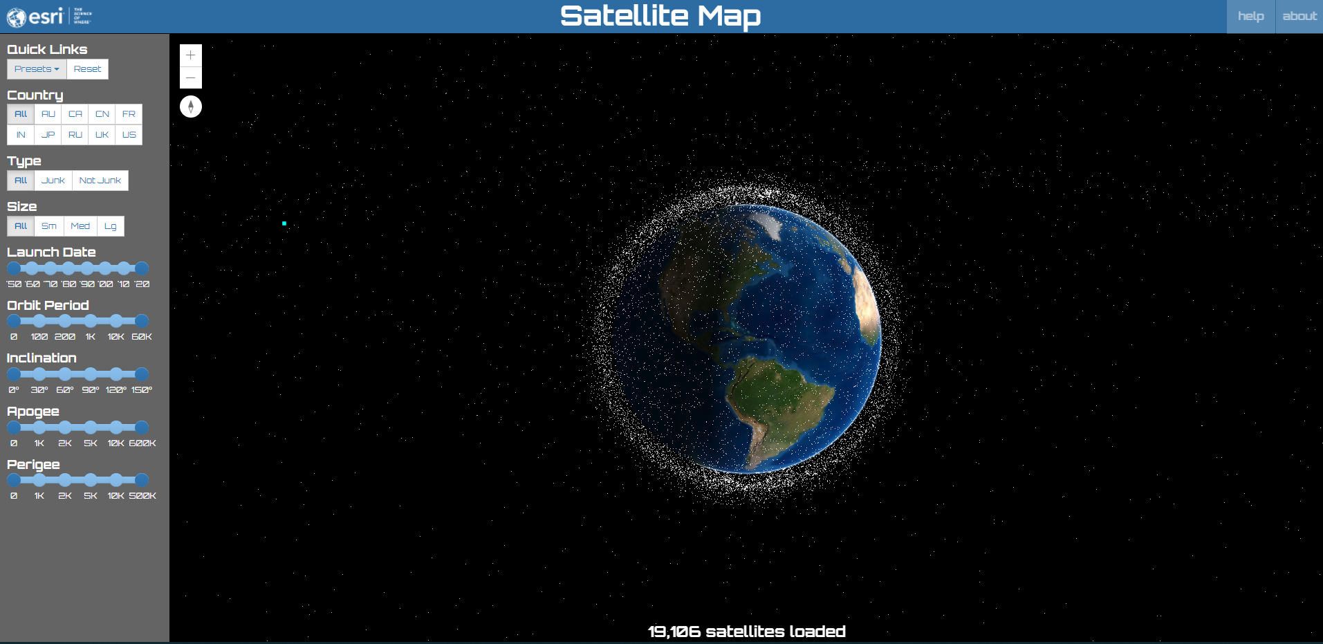
Before we get to outer space we have to get through a very cluttered inner space. According to the Union of Concerned Scientists (UCS) as of 2021 there are over 6542 man made satellites in orbit over our heads and in addition to that already staggering number we add to that one international space station, the Hubble Telescope, a variety of space junk, and small rock fragments in orbit as. All of these varied satellites have different orbits at different altitudes which make for a very busy sky. All of these satellites have to be accounted for every time a new one is launched. NASA and the US Department of Defense’s Space Surveillance Network share the task of cataloging and tracking items in orbit around the planet as they pose a significant risk to the International Space Station and any manned space launches. The map below was created by Esri and tracks approximately all of the satellites currently in orbit.
Beyond Earth
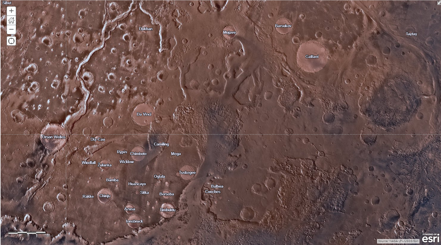
So now we have passed the obstacle course surrounding the earth and made it out into the expanse of space, so where do we turn our eyes next? The first stop, our neighbor Mars. Mars has been the subject of numerous probes, obitors and rovers. One of the more famous is the Mars Odyssey. This orbiter has been collecting spatial and geological data for over 20 years. The collected data is then transmitted back to scientists for further analysis. This information has allowed them to generate a detailed model of the planet, learn about the many different types of rocks and mineral formations, search for evidence of water, study tectonic shifts on the planet’s surface and plan routes for rovers as they explore the planet’s surface.
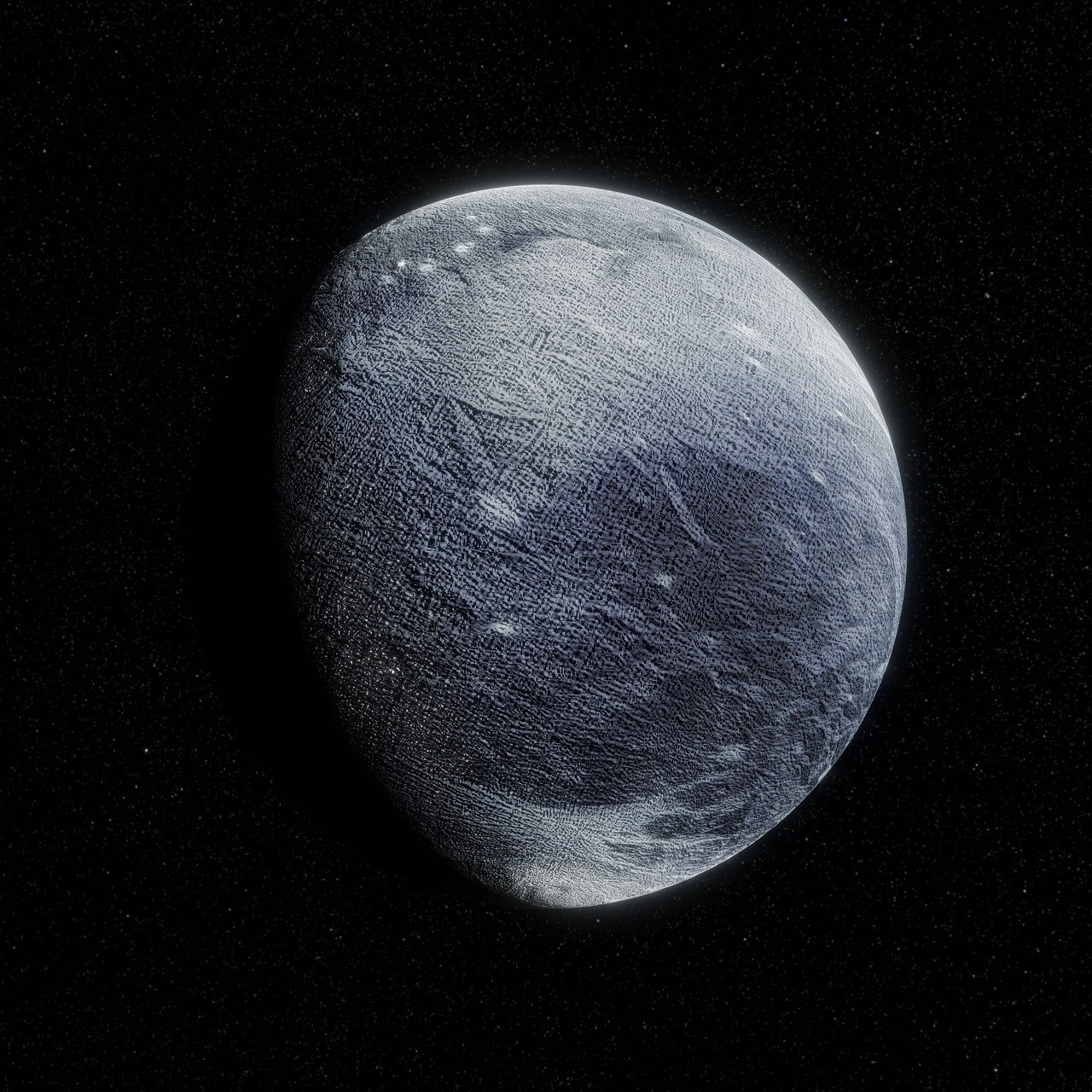
But Mars isn’t the only celestial body that we can explore with our GIS tools. Over the years we have sent a lot of probes into deep space and collected data on every planet in our solar system. NASA’s New Horizons mission when launched in 2006 was tasked with exploring the Pluto System and the Kuiper Belt, a region of the solar system beyond Neptune’s orbit made up of comets, asteroids, and other small bodies made largely of ice. The New Horizons probe was equipped with a variety of different instruments gathering tons of data. New Horizons gather more than 6.25 GB of data during its flyby of Pluto and its moons. Data returned by the New Horizons mission has allowed scientists a greater understanding of the nature of Pluto, its moons and the Kuiper Belt.
These are just a few of the ways Astrogeology incorporates GIS tools into the study of celestial bodies. If you are interested in learning more about Astrogeology and our neighbors in space check out the links below.
USGS: Astrogeology Science Center
NASA Science Solar System Exploration: New Horizons
To connect with us directly, email us at connect@geo-jobe.com
