


Common terms and abbreviations:
- UAV = Unmanned Aerial Vehicle
- sUAS = small Unmanned Aircraft System (less than 55lbs)
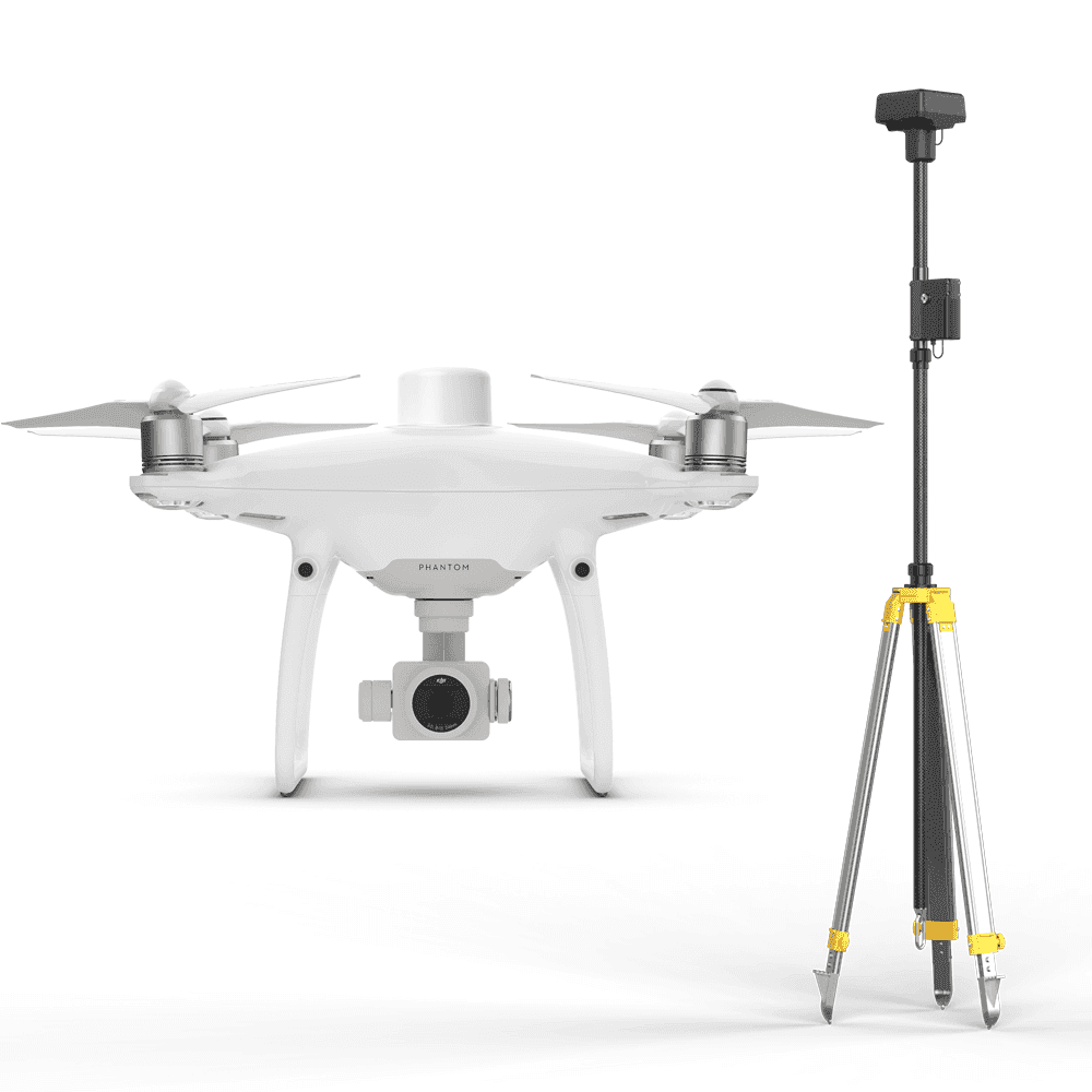
- RTK = Real Time Kinematic, high accuracy gnss positioning using local controls for correction and validation.
- GNSS = Global Navigation Satellite System(GPS-United States, BeiDou-China, Galileo-Europe, GLONASS-Russia)
- Photogrammetry = science and technology of making measurements using photographs. This process is designed to create a photographic image from which all errors have been removed.
When I tell people my job they’ll usually comment, “my friend has a drone.”
I just nod my head and smile. The word “drone” has become colloquial, conjuring thoughts of cheap children’s toys with poor controls, lacking sensors, and having little or no positioning. For that reason professional remote pilots seldom utter this dirty five letter word.
Accurate GNSS Positioning is one of three main features that distinguish professional UAV equipment from consumer drones. Intelligent flight planning and post processing applications are the other two ingredients needed to create accurate reality capture products.
Why is accurate location important?
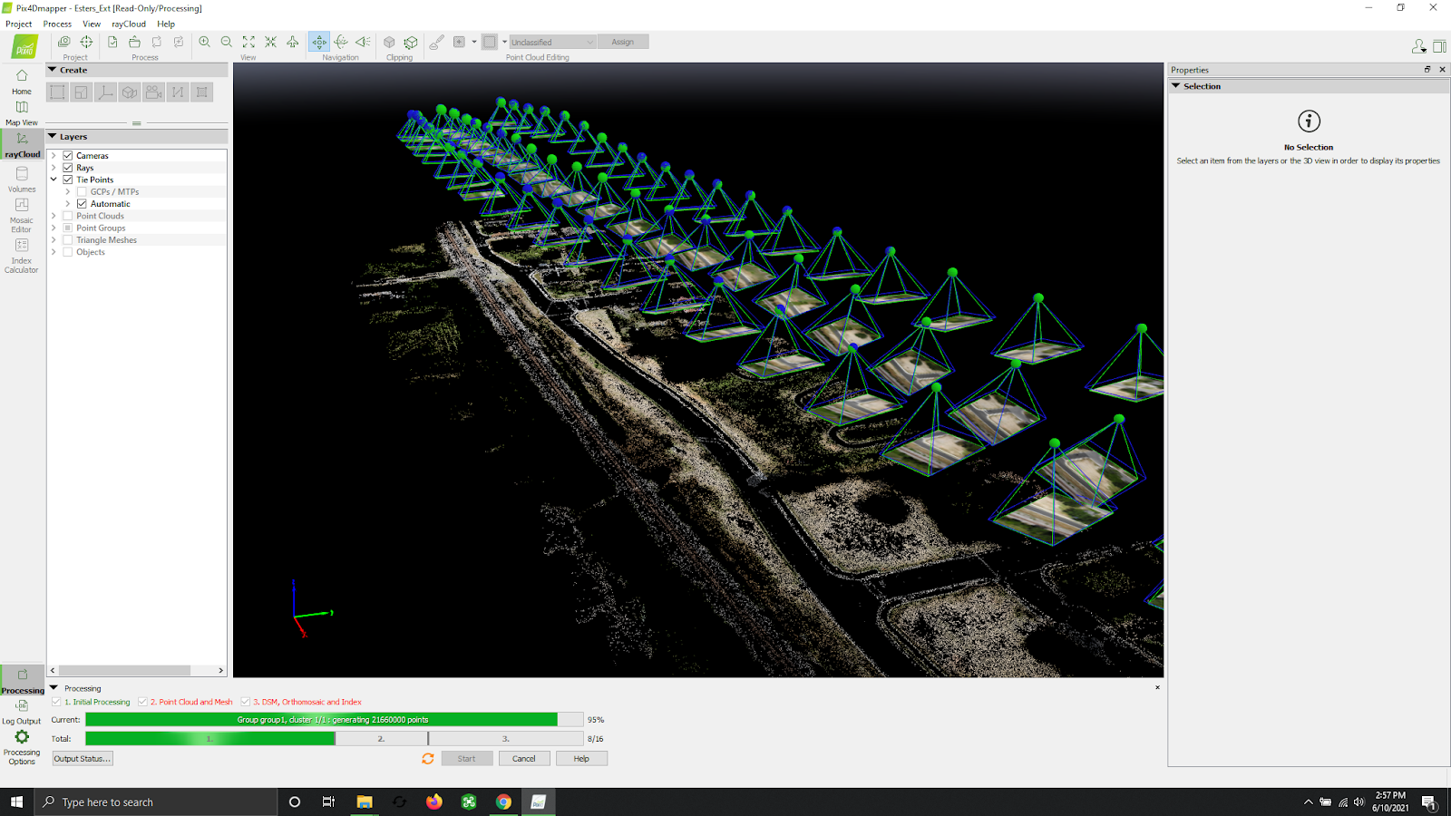
To create basemap imagery, UAVs capture many hundreds, or even thousands of photos, each one being “geotagged” with not only an accurate location, but also a precise timestamp of when that image was collected. This metadata is used to calibrate each image to a precise location, orientation, and time, ultimately producing an image that is accurate to within an inch and a half.
Some high end consumer drones can tag photos with location and timestamp information but they lack advanced GNSS sensors, the resulting location accuracy of consumer drones is around three feet. Location accuracy is everything. Whether we are calculating material volume or generating topographic contours, accurate location can mean the difference between profit and loss for our clients.
Programmed flight routines and Photogrammetry
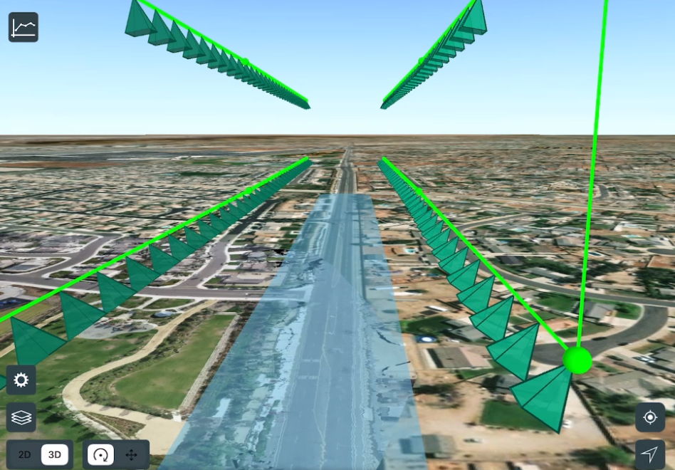
Flight planning software is the next piece of technology allowing professional UAV equipment to produce accurate maps and 3D models. Applications used by UAV professionals for mission planning are not the same as those found on consumer drones. UAV flight planning applications are much more advanced, including automation and highly customizable flight routines, which allow pilots to control every aspect of their UAV, including flight path, speed, elevation, overlap, camera event timing, and gimbal position. This advanced flight planning is critical to collecting data efficiently. For photogrammetry to work we need a certain amount of overlap in every image. Overlap allows the software to identify “tie points,” or positions the system has recognized as being common to at least two photographs; this fundamental element is a building block of photogrammetry. Professional UAV pilots meticulously plan flights to account for terrain, elevation, lighting conditions, weather, and airspace requirements. UAV flight planning applications distinguish between taking pictures for fun and collecting data for accurate reality capture products.
Post processing, GNSS correction
Post processing is a set of tasks that transform UAV data into high resolution and accurate digital maps. First is GNSS correction. Even though sensors found on UAV equipment are very good, there is still a small amount of error, and we correct for this error with RTK/PPK correction. Simply put, professional UAV pilots correct for errors in GNSS positioning by comparing the location of the UAV to a known point. This could be a local base station set up by the pilot or a regional CORS (continuously operating reference station) site. Without the advanced sensors found on professional UAV equipment, these corrections are not possible.
Advanced positioning systems, which allow GNSS correction; flight planning/automation; and photogrammetry are the three pillars of professional UAV equipment and each one is critical to the production of accurate reality capture products. Remove any one of these elements and you are left with little more than a folder of pretty pictures. So the next time you hear someone say to a remote pilot: “my friend has a drone.” you will know why they’re just giving a nod, and a smile.
