“Quality data is as essential to Machine Learning as practice and quality instruments are to an orchestra. Be the conductor.” In the ever-evolving world of machine […]
Unlocking the Future of Geospatial Insights In a world driven by data, where location is the linchpin connecting disparate information streams, the synergy between Databricks, Apache […]
Introduction In the field of Geographical Information Systems (GIS), tools that enable efficient data management and analysis are essential. ArcGIS Knowledge is a platform that enables […]
Written by Peter George and Tony Segero Processing speed can be a major crutch in geospatial data analytics. Integrating Apache Spark’s analytics engine can help expedite […]
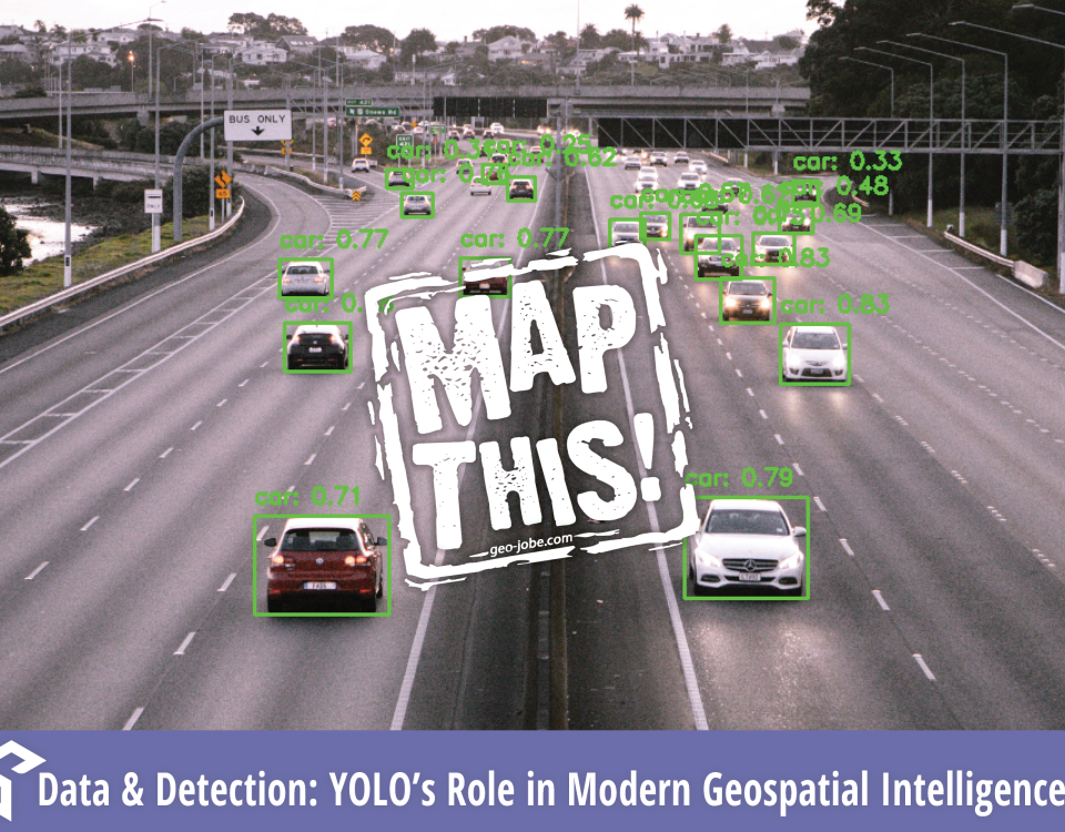
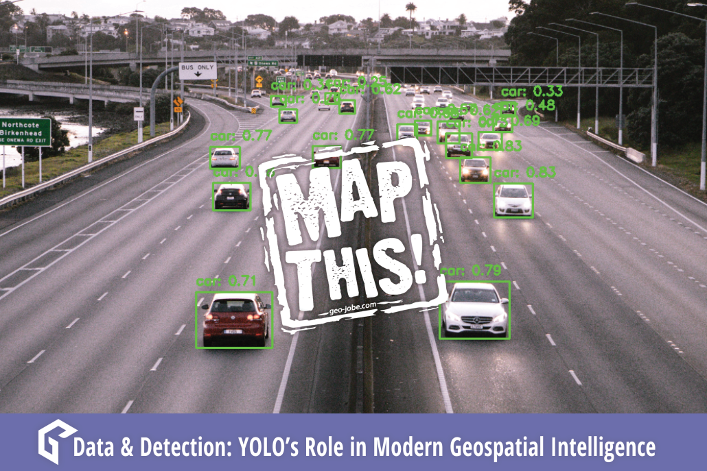
Recently, GEO Jobe explored image-based neural networks with GIS technology and maps. Convolutional Neural Networks, or CNNs, are a machine learning application that utilizes imagery to […]
Finding the correct balance of logic and appeal with data is often a struggle. Data can be bland, confusing, full of acronyms and numbers unknown to […]


