

GEO Jobe is pleased to share that we offer high resolution low altitude orthophotography services (see geo-jobe.com/
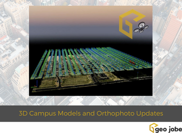
Recently, the team has had success producing an impressive 3D model as part of an aerial mapping and facilities inspection for the Meharry Medical College in Nashville, Tennessee. Using the high resolution data captured via low altitude UAV areal fly over the team has been able to put together photo realistic, 3D models for very large project areas (hundreds of acres in size) and this was no exception. Enjoy the short video that guides you around the campus facilities – a fine example of the kind of product you can expect from our facilities mapping services.
UAV flown digital data products can be used to produce such digital GIS data layers including DEM, DSM, contour, and ortho images. Most recently, GEO Jobe UAV also produced a 560+ acre digital ortho image update for Middle Tennessee State College (See below) – another example of a product that is a typical deliverable from a facilities mapping project. It seems College Campus planning, construction projects, and airport facilities are very interested in these products and workflows, with many clients from these sectors recently turning to GEO Jobe for their UAV mapping needs. See more about our UAV services www.geo-jobe.com/uav
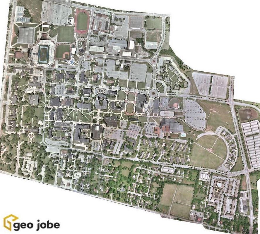
UAV flown, digital orthophoto update, Middle Tennessee State Campus
The GEO Jobe crew currently has four FAA licensed UAV remote pilots experienced in UAV and mobile data collection techniques for orthophotography updating, corridor mapping, asset inventory, terrain modeling, 3D building design models and more. GEO Jobe is prepared to support your mapping projects with a fleet of 4 drones using the latest UAV technologies. If we can help your organization or support your GIS and mapping projects with UAV expertise please feel free to contacts us here with a comment (below), reach out via tweet (we have a dedicated UAV topic account @geojobeuav), connect on our UAV facebook page.
See also www.geo-jobe.com/uav
Note: Find GEO UAV Services on Facebook and Twitter/Instagram @geojobeuav
See Also:
- UAV Data Collection Supports Infrastructure Mapping, 3D, and Higher Resolution GIS at a Lower Cost
- GEO Jobe UAV Secures Official FAA Authorization for UAV Mapping Flights on Airport Lands
