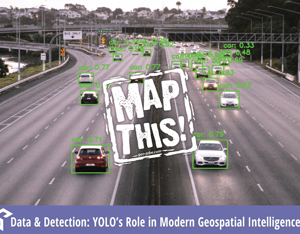
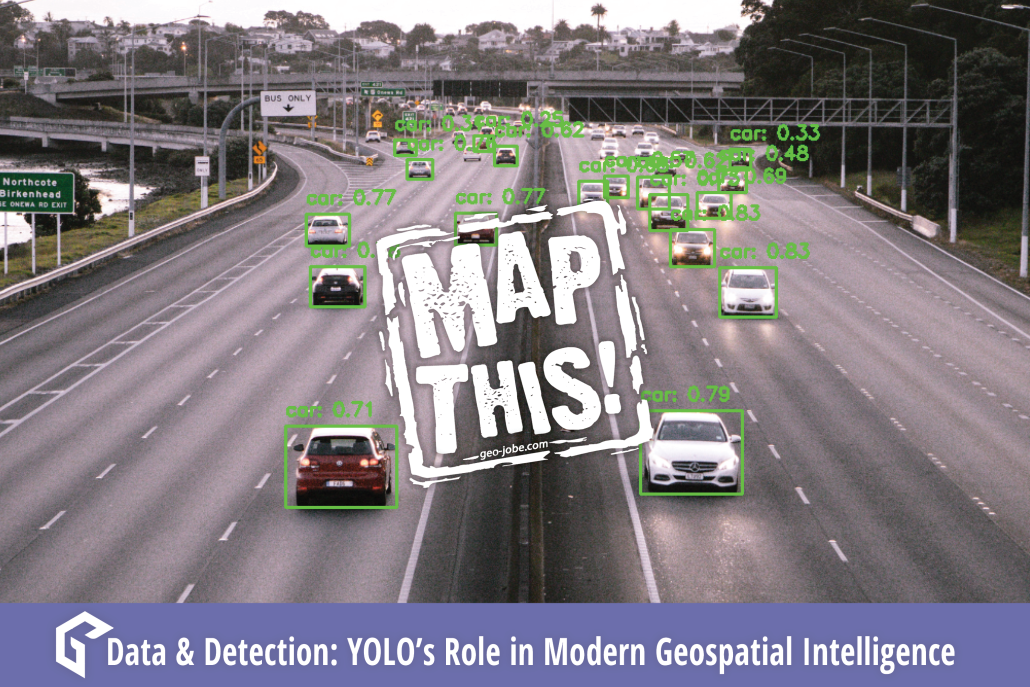
“Quality data is as essential to Machine Learning as practice and quality instruments are to an orchestra. Be the conductor.” In the ever-evolving world of machine […]
Image generated by DALL-E using Microsoft’s Copilot Our world is undergoing a technological transformation as search engines on the World Wide Web have replaced our necessity […]
What Are GIS Services? GIS services can be a wide range of services such as UAV digital mapping, solution engineering, or spatial data collection/development. Services such […]
Unlocking the Future of Geospatial Insights In a world driven by data, where location is the linchpin connecting disparate information streams, the synergy between Databricks, Apache […]
Written by Peter George and Tony Segero Processing speed can be a major crutch in geospatial data analytics. Integrating Apache Spark’s analytics engine can help expedite […]
Imagine for a moment walking through a dense and lush jungle landscape. You come across a deteriorating shell of a building long reclaimed by nature. In your mind, […]


