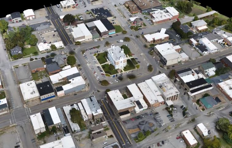
December 5, 2017Published by GEO Jobe on December 5, 2017Categories NewsNews – GEO Jobe UAV Recognized by Pix4D for 3D Drone Mapping for Smart CitiesOur latest news/PR shares details of our UAV and Aerial Mapping Services group being recognized by industry leader, Pix4D, for “Smart City” mapping and the creation […]
November 29, 2017Published by GEO Jobe on November 29, 2017Categories News UAVGEO Jobe UAV Services Recognized by Pix4D – Lewisburg, Tennessee Drone-Mapping for Smart CitiesGEO Jobe UAV Services group has been extremely busy this fall flying season, and there’s no sign of slowing down any time soon – although a […]