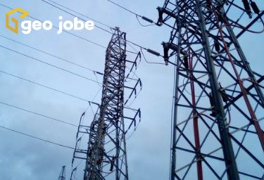
Vertical assets such as communications, tall buildings, or water towers are difficult and dangerous to inspect. For this reason, UAV technology is quickly becoming the preferred method of vertical asset inspection. Three primary reasons UAV inspections are becoming prominent are safety, time savings, and superior documentation; these are just some of the immediate benefits we […]
Tag: utilities
Where Is Your Data? CAD to GIS Conversion
If you work in a GIS or Engineering field, you are likely incredibly familiar with either CAD or GIS, but behind the curve when it comes to the other. This makes sense and is completely understandable when your work focuses more on one program. CAD, or Computer Aided Drawing, is a program used by a […]
GeoConX 2019 – Get Connected!
The boys are back in town! We are pleased to be back for GeoConX 2019, taking place October 27-30 at the Cobb Galleria Center in Atlanta, GA. Our very own David Hansen and Danny Menikheim will be manning our booth – #421. Whether this is your first GeoConX conference or you’re a seasoned veteran, you […]
News – GEO Jobe Showcasing UAV Services, GEOPowered Cloud Managed Services, ArcGIS Solutions for Utilities, at Esri GeoConX
NASHVILLE, Tenn. – Oct. 22, 2018 – PRLog — GEO Jobe is pleased to announce we will be exhibiting at this year’s GeoConX Conference.
GEO Jobe at the 2018 GeoConX Conference, Where Electric, Gas, and Telecomm Communities converge!
GEO Jobe is pleased to be exhibiting at this year’s GeoConX Conference which will take place November 5-8 in Dallas, Texas.
Learn About security.manager ArcGIS Edition at the European Petroleum GIS Conference (EPUG)
Are you heading to the Esri European Petroleum GIS Conference in London next week? If so, we encourage you to be sure to visit our colleagues @conterra to learn about security.manager ArcGIS Edition – fine-grained access control in ArcGIS!
Admin Tools for Portal FAQ and Reasons to Adopt Admin Tools Portal for ArcGIS
Thursday is a great day to look back on all the great stuff from the past, even if it was just one short year ago. Updates on the web and on social media come and go in the blink of an eye, so we want to take advantage of the Throwback Thursday concept (#TBT) to […]
Florida Power Outages – Gain Situational Awareness with Operations Dashboard for ArcGIS
Operations Dashboard (Beta) for ArcGIS is a powerful solution for enterprise users to provide a common view of the systems and resources you manage. Using the dashboard, the user can create intelligent, focused executive dashboards that integrate maps, charts, and graphs. Esri recently pushed out a view using the dashboard to share the status of […]
News – West Wilson Utility District Turns to GEO Jobe for UAV Data Capture & Orthophoto Updates
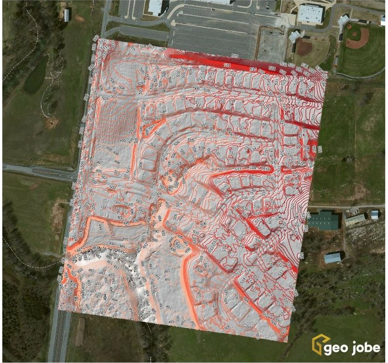
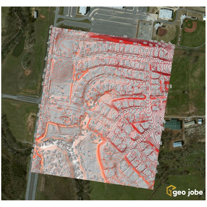
Local governments, utilities, and facility managers have a new resource at their disposal to help keep their GIS land base current and up to date while also saving money. Our latest news release shares details of a UAV orthophoto update project for West Wilson Utilities District, Wilson County. The project has resulted in significant cost […]
Esri Announces Availability of Drone2Map 1.2 for ArcGIS
Esri has just announced the release of Drone2Map 1.2, the company’s solution for working with and managing your UAV captured data, just in time for ESRIUC. Drone2Map for ArcGIS enables users to take UAV/UAV, drone-captured imagery into 2D and 3D imagery products in ArcGIS. Using Drone2Map you can create orthophotos, digital surface models (DSM), digital […]