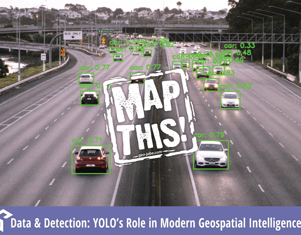
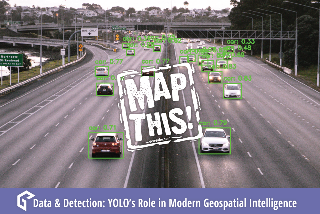
“Quality data is as essential to Machine Learning as practice and quality instruments are to an orchestra. Be the conductor.” In the ever-evolving world of machine […]
Recently, GEO Jobe explored image-based neural networks with GIS technology and maps. Convolutional Neural Networks, or CNNs, are a machine learning application that utilizes imagery to […]
Last August, we covered some of the highest-level concepts about GeoAI in an attempt to demystify it. If you haven’t already, I recommend reading that article […]
As a geospatial professional in 2020, it’s nearly impossible to avoid being exposed to the ideas of AI, machine learning, and deep learning. Projects utilizing these […]
GEO Jobe’s VP of Product Development, David Hansen, sat down earlier this year at DevSummit to discuss the GEO Jobe roadmap, the ArcGIS Ecosystem at 10.5 […]


