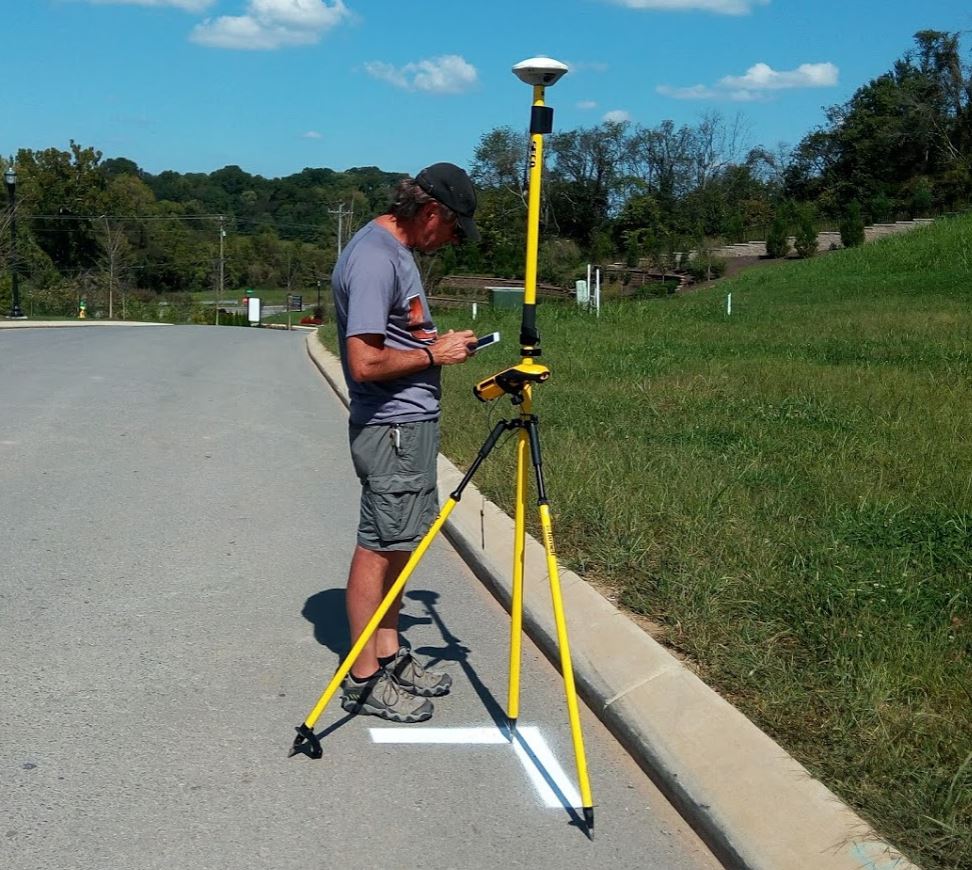
GEO Jobe’s UAV Services Group launched about 2 years ago, expanding our professional services offerings in Unmanned Aerial Vehicle (UAV) flight planning, data analysis, and aerial mapping. The UAV Group provides orthophoto planimetric mapping products, rectified mosaics, digital surface models (DSM), digital terrain models (DTM), and 3D models as well as UAV data hosting & image services.
“With Jeff’s addition combined with the team we currently have in place, we’re primed to continue our growth in UAV mapping services to support existing and new clients, particularly throughout Tennessee and surrounding areas. GEO Jobe UAV services currently has clients in local government, utilities (electric, water, oil and gas), construction, real estate, agriculture, and facilities management.” Neill Jobe, GEO Jobe, CEO
Meet Jeff Lawrence who heads up business development with GEO Jobe’s UAV Services Team:
Q: What is your role at GEO Jobe?
A: My role at GEO Jobe is a licensed UAV pilot in the UAV division. I plan, estimate, fly and process drone aerial mapping missions for our mapping clients.
Q: What is your Educational/Professional background, and how did you wind up at a GEO/GIS company?
A: I have a Masters in Economics, and more than 20 years using and/or managing a municipal GIS.
Q: What were you up to before life at GEO Jobe?
A: Before GEO Jobe, I was working at an Engineering firm assisting a client analyze and maintain their pavement management systems.
Q: What attracted you to joining the GEO Jobe team?
A: Neill Jobe and I have worked together in the past, so that was a strong draw. Being in on the early adoption of IoT technology like the drones for aerial photography was too good to pass up!
Q: What do you enjoy doing outside of the office?
A: I bicycle, and do small woodworking projects.
Q: The UAV side of the business has really taken off. What kind of jobs do you enjoy working on and is there a specific kind of project you’d like to tackle in the future (like a dream job)?
A: I saw a post on a drone forum asking for members’ most boring drone job. That contradiction confused me…. Every UAV is different. So it just doesn’t get old. I want to fly and map an archaeology site. I want to create a high resolution digital map to help identify burial mounds or graves that have been overlooked by traditional means. We have an opportunity right near our office. Andrew Jackson’s Hermitage is nearby. There may be some interest in using detailed topo mapping to find abandoned and unmarked slave graves they suspect are there but yet undiscovered.
Q: What kind of technology do you prefer and why? (Mac or PC, iOS or Android, and other cool tech)
A: I use both MAC and PC. I prefer the iOS for my phone.
Q: If you weren’t in the career that you are right now what could you imagine yourself doing?
A: Full time furniture making
Q: Can you share something about a cool project you enjoyed working on lately and why?
A: We did a city wide mapping project in Tiptonville Tennessee. Reelfoot Lake was at the Eastern edge of the extent. This is a lake that was created in the aftermath of the record continental US earthquake in 1812. The 8.8 quake in the Spring of that year was so strong and violent that it rearranged the banks and flow of the Mississippi River. The Mighty Mississippi actually flowed backwards for several hours spilling over into the nearby Cypress forest turning it into Reelfoot Lake. (There is a whole history and wild wild west kind of story about the property owners that lost property to the inundation – hangings, killings and such.) The Lake is now home to 50-75 pairs of Bald Eagles and many other birds of prey and aquatic animals, snakes, turtles and fish right there near the boardwalk trail. The Park visitor’s center has outdoor bird pens of Owls, Red Tail Hawks and Bald Eagles that have been injured and are there for rehabilitation. The Cypress trees are unique and amazing to see. Boring Drone job? I don’t know what you mean!
Thanks to Jeff for sharing! If you’d like to pick Jeff’s brain about UAV technology and get some ideas about how GEO Jobe UAV services can assist your organization, connect with Jeff on Twitter @Jalaw3
See Also:
- GEO Jobe Employee Spotlight – Meet Nick Lawalin, Solution Engineer
- GEO Jobe Employee Spotlight – Meet Blake Bilbo
- More GEO Jobe Employee Spotlights
Here is the 3D Point cloud of a 5.5 mile corridor. Got us flying in two new States for us! Indiana and Kentucky. #drone #UAV #transportation #realitycapture #wemakemaps https://t.co/YpnEZMokmE
— jalaw3 (@jalaw3) May 30, 2018