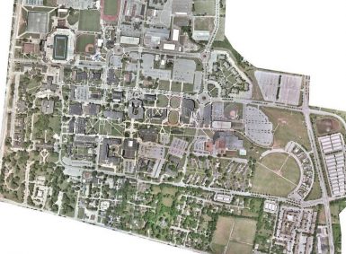
GEO Jobe flew the entire campus in order to provide up to date maps, orthophotos, and a highly accurate digital basemap.
Archives: UAV Case Studies
These are used to populate the UAV Case Studies page.
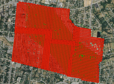
UAV Flight Mission Planning
Professional Flight mission planning and data coverage reporting while our UAV/UAS (drone) based data capture crews get in, get out, start the analysis, and finally, deliver a high quality product, often at a cost to clients that blows their mind! Indeed, the combination of our experience and expertise in GIS, the ArcGIS ecosystem, custom application […]
Orthophotography Update
Orthophotography updates, ideal for local government, utilities and others needing GIS data updates. UAV orthophoto update project for West Wilson Utilities District, Wilson County. The project has resulted in significant cost savings for the district and now the region is the envy of surrounding agencies, being in the fortunate situation where instead of the Orthophotos […]
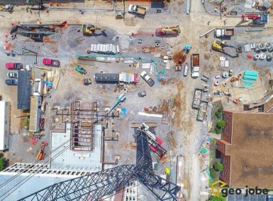
Construction Projects
The construction industry, in particular, has been a large and growing sector for our UAV Services group. Many benefits are realized by these clients who are electing to employ UAV data capture technologies and methods. Most notably, UAV data capture is safe and secure, can be flown relatively quickly, and data products are accurate and […]
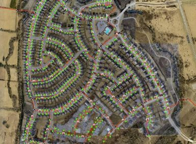
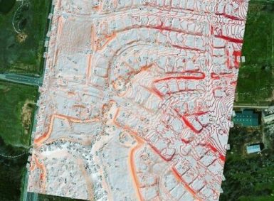
Subdivision Mapping
UAV mapping for new construction of a 500 acre subdivision update with water lines.

Lewisburg, TN
Lewisburg, TN The Lewisburg water utility is a GEO Jobe GIS Consulting client, contracting GEO Jobe for a number of services, including mapping their utility assets and network. GEO Jobe secured a contract to provide base mapping services and feature extraction for the City of Lewisburg. We used photogrammetry to create orthomosaics to assist the […]