Leveraging Inline Variable Substitution Introduction ModelBuilder™ is a tool within ArcGIS® Pro that allows the user to combine different geoprocessing tools and steps to help automate geoprocessing workflows. ModelBuilder enables users to connect various geoprocessing tools built into ArcGIS Pro and custom geoprocessing tools in a set sequence to reach desired data output(s). The model […]
Tag: ArcGIS Pro
Powering Geoanalytics with Databricks and Spark Integration
Unlocking the Future of Geospatial Insights In a world driven by data, where location is the linchpin connecting disparate information streams, the synergy between Databricks, Apache Spark, and Esri’s Geoanalytics Engine emerges as a formidable force—a triumvirate reshaping the very landscape of geospatial analytics. The era of data-driven decision-making has dawned upon us, and at […]
Conquer Space and Time with Spatiotemporal Rasters
Leveraging Rasters for a Spatiotemporal Analysis When data is collected across different time frames spatially and then brought together in one collection to create a spatiotemporal model, this allows the user to visually see spatial patterns in a given location over time. Spatiotemporal data is very powerful for observing growth, patterns, and changes with respect […]
Admin Tools for ArcGIS 2.1.3 Out Now
Earlier this month, we released an update to Admin Tools for ArcGIS. In the last six months, we’ve been busy building new tools, polishing existing ones, and fixing some minor bugs. Read on to find out what’s changed and how to make sure your version is up-to-date! New Features Update Stored Credentials When customers contact […]
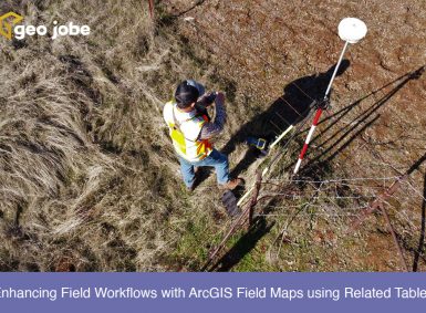
Enhancing Field Workflows with ArcGIS Field Maps using Related Tables
ArcGIS Field Maps is a powerful application within the Esri ecosystem that helps streamline workflows for data capture and asset monitoring out in the field. Multiple use cases for field maps have been utilized, from mapping sightings of invasive species to tracking damage to homes after storms. One of the most common use cases is […]
Clean My Org 1.6 Update
Clean My Org version 1.6 is now available! Clean My Org 1.6 brings significant enhancements and fixes, including an improved scanning engine. The scanning engine has been rebuilt from the ground up and incorporates major improvements in speed as well as increased memory efficiency for organizations with a very large number of items. The new […]
How to Reconfigure Layer Files in ArcGIS Pro
Symbology is one of those things that can make or break a map. If it is not clear and intuitive, users can be left feeling frustrated by the lack of clarity and the amount of time it takes to find what they are looking for. (I can’t be the only person who walks away grumbling […]
Get to Know Your Toolbox: Work Smarter, Not Harder with Custom Script Tools
Esri provides a comprehensive suite of geoprocessing tools that we use to run spatial analysis and manage our GIS data. Depending on your workflow, you may use the same tools over and over again on a daily basis. However, have you ever wished you could have one tool that would streamline your workflow? With script […]
Unlocking Experience Builder’s Power with Triggers and Actions
ArcGIS Experience Builder is a powerful tool that enables us to build interactive and dynamic web applications with ease. In this post, we will discuss two key features of Experience Builder that allow us to create responsive and engaging experiences for our users: triggers and actions. We’ll explore what they can do and how we […]
Get to Know Your Toolbox – Tools Used to Cache Imagery in ArcGIS Pro and Publish to ArcGIS Online!
Do you have imagery you would like to upload to ArcGIS Online for a basemap? Well, this article is going to take you through the steps to get you there. Come with me as we create you a custom basemap! Prepping your Imagery The first step in caching imagery is to create a mosaic dataset […]


